 Old Cumbria Gazetteer
 |
 |
|
| Wreay Bridge, Wreay | ||
| Wreay Bridge | ||
| site name:- | Petteril, River | |
| civil parish:- | St Cuthbert Without (formerly Cumberland) | |
| civil parish:- | Hesket (formerly Cumberland) | |
| county:- | Cumbria | |
| locality type:- | bridge | |
| coordinates:- | NY44064852 | |
| 1Km square:- | NY4448 | |
| 10Km square:- | NY44 | |
|
|
||
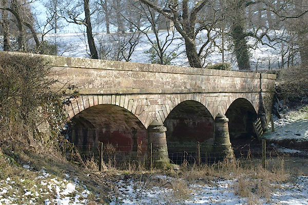 BSF33.jpg (taken 2.3.2010) |
||
|
|
||
| evidence:- | old map:- OS County Series (Cmd 31 5) placename:- Wreay Bridge |
|
| source data:- | Maps, County Series maps of Great Britain, scales 6 and 25
inches to 1 mile, published by the Ordnance Survey, Southampton,
Hampshire, from about 1863 to 1948. |
|
|
|
||
| evidence:- | old map:- OS County Series (Cmd 31) placename:- Wreay Bridge |
|
| source data:- | Maps, County Series maps of Great Britain, scales 6 and 25
inches to 1 mile, published by the Ordnance Survey, Southampton,
Hampshire, from about 1863 to 1948. "Wreay Br." |
|
|
|
||
| evidence:- | database:- Listed Buildings 2010 |
|
| source data:- | courtesy of English Heritage "BRIDGE, ROAD OVER RIVER PETTERIL / / / ST CUTHBERT WITHOUT / CARLISLE / CUMBRIA / II / 77607 / NY4406848520" |
|
| source data:- | courtesy of English Heritage "WREAY BRIDGE / / / HESKET / EDEN / CUMBRIA / II / 73928 / NY4406948519" |
|
| source data:- | courtesy of English Heritage "Bridge over River Petteril, 183O's. Red sandstone ashlar with channelled joints and voussoirs. 3 round-headed arches, 2 piers, single width. Rounded cut-waters to piers, string course and coped parapet. Half of this bridge lies within the parish of Hesket." |
|
|
|
||
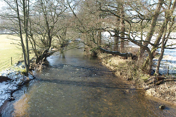 BSF34.jpg View of river. (taken 2.3.2010) |
||
|
|
||
 Lakes Guides menu.