 Old Cumbria Gazetteer
 |
 |
|
| Workington Turnpike | ||
| site name:- | road, Workington to Maryport (?) | |
| civil parish:- | Workington (formerly Cumberland) | |
| county:- | Cumbria | |
| locality type:- | buildings | |
| locality type:- | toll house (ex) | |
| locality type:- | toll gate (site) | |
| coordinates:- | NY00732916 | |
| 1Km square:- | NY0029 | |
| 10Km square:- | NY02 | |
| references:- | OS County Series |
|
|
|
||
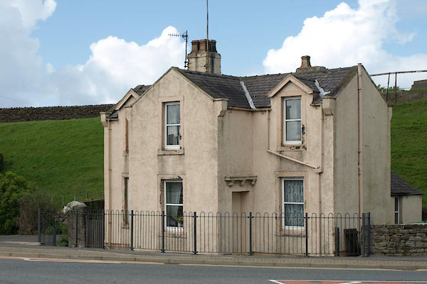 BUO08.jpg (taken 13.5.2011) |
||
|
|
||
| evidence:- | old map:- OS County Series (Cmd 53 7) |
|
| source data:- | Maps, County Series maps of Great Britain, scales 6 and 25
inches to 1 mile, published by the Ordnance Survey, Southampton,
Hampshire, from about 1863 to 1948. "Workington T.P." at a T junction; gates on two roads, and a building |
|
|
|
||
 Lakes Guides menu.