 Old Cumbria Gazetteer
 |
 |
|
| Sweet Bridge, Grayrigg | ||
| Sweet Bridge | ||
| site name:- | Whinhowe Gill | |
| civil parish:- | Grayrigg (formerly Westmorland) | |
| civil parish:- | Whinfell (formerly Westmorland) | |
| county:- | Cumbria | |
| locality type:- | bridge | |
| coordinates:- | SD57319802 | |
| 1Km square:- | SD5798 | |
| 10Km square:- | SD59 | |
|
|
||
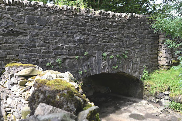 CGI70.jpg and sheep underneath! (taken 10.8.2017) 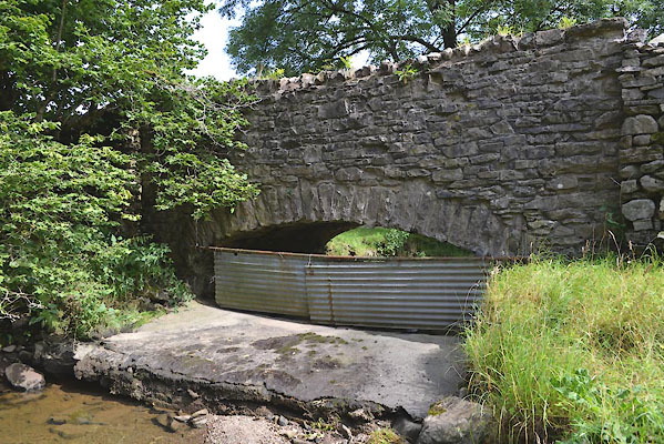 CGI71.jpg (taken 10.8.2017) |
||
| There has been low rainfall for the last mmonth or so. |
||
|
|
||
| evidence:- | old map:- OS County Series (Wmd 34 6) placename:- Sweet Bridge |
|
| source data:- | Maps, County Series maps of Great Britain, scales 6 and 25
inches to 1 mile, published by the Ordnance Survey, Southampton,
Hampshire, from about 1863 to 1948. |
|
|
|
||
 Lakes Guides menu.