 Old Cumbria Gazetteer
 |
 |
|
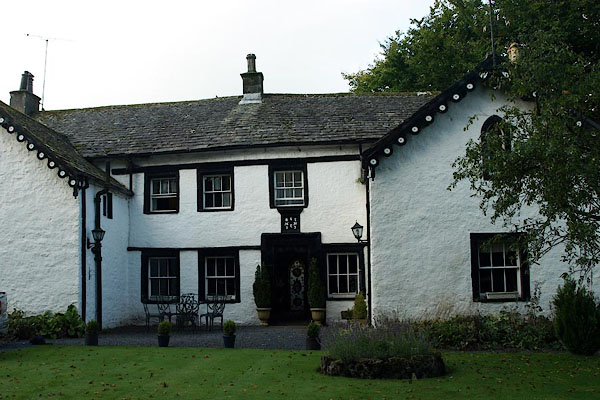
| Hermitage, Shap | ||
| locality:- | Shap | |
| civil parish:- | Shap (formerly Westmorland) | |
| county:- | Cumbria | |
| locality type:- | buildings | |
| coordinates:- | NY56171548 | |
| 1Km square:- | NY5615 | |
| 10Km square:- | NY51 | |
|
|
||
 BPR10.jpg (taken 26.9.2008) 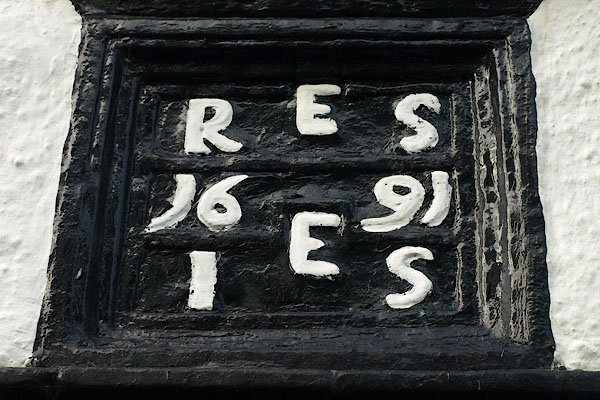 BPR11.jpg Date stone:- "E / R S / 16 91 / E / I S" (taken 26.9.2008) |
||
|
|
||
| evidence:- | database:- Listed Buildings 2010 placename:- Hermitage, The item:- date stone (1691) |
|
| source data:- | courtesy of English Heritage "THE HERMITAGE / / MAIN STREET / SHAP / EDEN / CUMBRIA / II / 74172 / NY5616815482" |
|
|
|
||
 Lakes Guides menu.