 Old Cumbria Gazetteer
 |
 |
|
| school, Penny Bridge | ||
| Penny Bridge School | ||
| locality:- | Penny Bridge | |
| civil parish:- | Egton with Newland (formerly Lancashire) | |
| county:- | Cumbria | |
| locality type:- | school | |
| coordinates:- | SD30918255 | |
| 1Km square:- | SD3082 | |
| 10Km square:- | SD38 | |
|
|
||
| MN photo:- |
This could be the old school building, very much altered. |
|
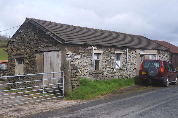 CEY19.jpg (taken 29.4.2016) |
||
|
|
||
| evidence:- | old map:- OS County Series (Lan 11) |
|
| source data:- | Maps, County Series maps of Great Britain, scales 6 and 25
inches to 1 mile, published by the Ordnance Survey, Southampton,
Hampshire, from about 1863 to 1948. "National School" |
|
|
|
||
 Lakes Guides menu.