 Old Cumbria Gazetteer
 |
 |
|
| school, Longlands | ||
| locality:- | Longlands | |
| civil parish:- | Kingwater (formerly Cumberland) | |
| county:- | Cumbria | |
| locality type:- | school (ruin) | |
| coordinates:- | NY55526769 | |
| 1Km square:- | NY5567 | |
| 10Km square:- | NY56 | |
|
|
||
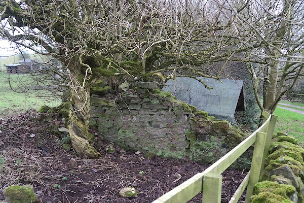 CEN05.jpg A gable end remains. (taken 25.1.2016) |
||
|
|
||
| evidence:- | old map:- OS County Series (Cmd 12 6) |
|
| source data:- | Maps, County Series maps of Great Britain, scales 6 and 25
inches to 1 mile, published by the Ordnance Survey, Southampton,
Hampshire, from about 1863 to 1948. "School" |
|
|
|
||
 Lakes Guides menu.