 Old Cumbria Gazetteer
 |
 |
|
| school, Castletown | ||
| Castletown School | ||
| locality:- | Castletown | |
| civil parish:- | Rockcliffe (formerly Cumberland) | |
| county:- | Cumbria | |
| locality type:- | school | |
| coordinates:- | NY35316201 | |
| 1Km square:- | NY3562 | |
| 10Km square:- | NY36 | |
| references:- | OS County Series |
|
|
|
||
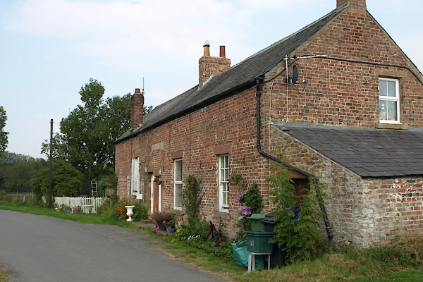 BTM65.jpg (taken 3.9.2010) |
||
| The building has had various uses. It was once a barn. It was once the house of an
exciseman whose duties included stopping smuggling across the River Eden. One method
used by the smugglers was to tie a container of brandy round the neck of a dog that
was encouraged to swim across the river. |
||
|
|
||
| evidence:- | old map:- OS County Series (Cmd 16 5) |
|
| source data:- | Maps, County Series maps of Great Britain, scales 6 and 25
inches to 1 mile, published by the Ordnance Survey, Southampton,
Hampshire, from about 1863 to 1948. "School" |
|
|
|
||
 Lakes Guides menu.