 Old Cumbria Gazetteer
 |
 |
|
| Villa Marina, Roa Island | ||
| Villa Marina | ||
| locality:- | Roa Island | |
| civil parish:- | Barrow-in-Furness (formerly Lancashire) | |
| county:- | Cumbria | |
| locality type:- | buildings | |
| coordinates:- | SD23296487 | |
| 1Km square:- | SD2364 | |
| 10Km square:- | SD26 | |
|
|
||
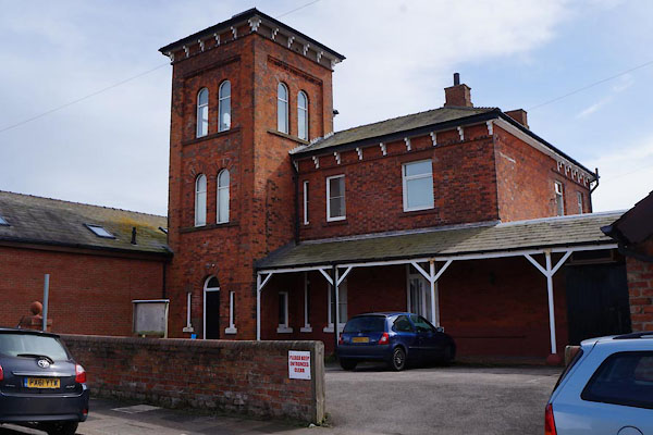 CAG06.jpg (taken 4.4.2014) |
||
| Said to have been built by a local councillor, who had cannons at the door. It once
served as the lifeboat station? |
||
|
|
||
| evidence:- | old map:- OS County Series (Lan 28 1) placename:- Villa Marina |
|
| source data:- | Maps, County Series maps of Great Britain, scales 6 and 25
inches to 1 mile, published by the Ordnance Survey, Southampton,
Hampshire, from about 1863 to 1948. |
|
|
|
||
 Lakes Guides menu.