 Old Cumbria Gazetteer
 |
 |
|
| Rockcliffe Station, Rockcliffe | ||
| Rockcliffe Station | ||
| site name:- | Caledonian Railway | |
| locality:- | Rockcliffe | |
| civil parish:- | Rockcliffe (formerly Cumberland) | |
| county:- | Cumbria | |
| locality type:- | railway station | |
| coordinates:- | NY37016116 | |
| 1Km square:- | NY3761 | |
| 10Km square:- | NY36 | |
| references:- | OS County Series |
|
|
|
||
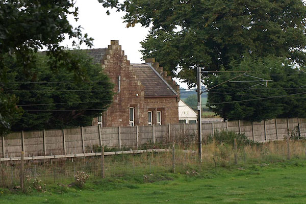 BTM73.jpg (taken 3.9.2010) 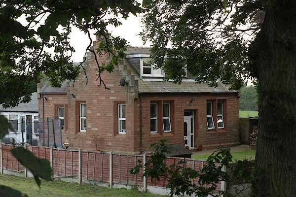 BTM76.jpg (taken 3.9.2010) |
||
|
|
||
| evidence:- | old map:- OS County Series (Cmd 16 6) placename:- Rockcliff Station |
|
| source data:- | Maps, County Series maps of Great Britain, scales 6 and 25
inches to 1 mile, published by the Ordnance Survey, Southampton,
Hampshire, from about 1863 to 1948.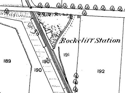 click to enlarge click to enlargeCSRY0031.jpg "Rockcliff Station" |
|
|
|
||
 Lakes Guides menu.