 Old Cumbria Gazetteer
 |
 |
|
| Podgill Viaduct, Hartley | ||
| Podgill Viaduct | ||
| site name:- | South Durham and Lancashire Union Railway | |
| site name:- | Pod Gill | |
| civil parish:- | Hartley (formerly Westmorland) | |
| county:- | Cumbria | |
| locality type:- | railway viaduct | |
| locality type:- | viaduct | |
| coordinates:- | NY78130787 | |
| coordinates:- | NY78200797 | |
| 1Km square:- | NY7807 | |
| 10Km square:- | NY70 | |
|
|
||
 BVZ65.jpg (taken 2.3.2012) 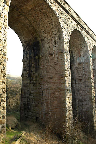 BVZ66.jpg Old and new building work. (taken 2.3.2012) |
||
|
|
||
| evidence:- | old map:- OS County Series (Wmd 23) placename:- Podgill Viaduct |
|
| source data:- | Maps, County Series maps of Great Britain, scales 6 and 25
inches to 1 mile, published by the Ordnance Survey, Southampton,
Hampshire, from about 1863 to 1948. "Podgill Viaduct" |
|
|
|
||
| evidence:- | database:- Listed Buildings 2010 placename:- Pod Gill Viaduct |
|
| source data:- | courtesy of English Heritage "POD GILL VIADUCT / / / HARTLEY / EDEN / CUMBRIA / II / 448530 / NY7817907929" |
|
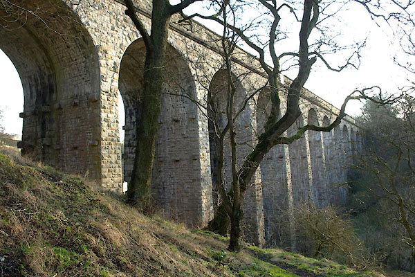
| source data:- | courtesy of English Heritage "Railway Viaduct. Built in 1861, widened 1889, for the Stockton, Darlington and Lancashire Union Railway. (North-Eastern Railway) to span the valley of the Ladthwaite Beck. Engineer Thomas Bouch, contractors Chambers and Hilton. Opened as a single line structure in August 1861, and doubled in width in 1889. Constructed of snecked and coursed squared rubble sandstone, with rusticated voussoirs and finely jointed ashlar soffits. The south-east line is of larger block than the north-west. A straight viaduct, 466 feet in length, and incorporating 11 semi-circular headed arches, each 30 feet wide. The Viaduct is 84 feet high at its tallest point, and is carried by tall, tapered rectangular piers, with 2 rows of corbels at the heads of the piers formerly used to support constructional formwork for the arches. Parapets rise from moulded courses above arch heads and terminate at plain ashlar parapets. Splayed abutments with shallow pilasters to side walls, terminating at rectangular upstands With shallow pyramidal caps. At the time of widening, refuges of unusual design were created in the thickness of the walls, and shielded on the outsides by cast-iron plates shaped to the profile of the copings. There are 4 such refuges on the south-east side, and 3 to the north-east. A dramatically set viaduct by a notable bridge engineer, of particular interest as an example of a widened structure, the 2 phases displaying different constructional characteristics." |
|
|
|
||
 BVZ63.jpg View W. (taken 2.3.2012) 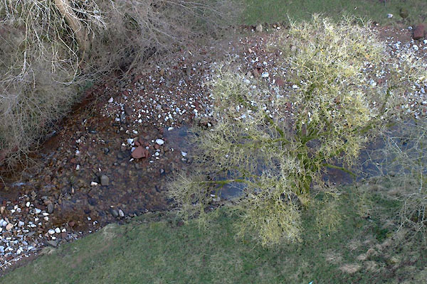 BVZ64.jpg Ladthwaite Beck below. (taken 2.3.2012) 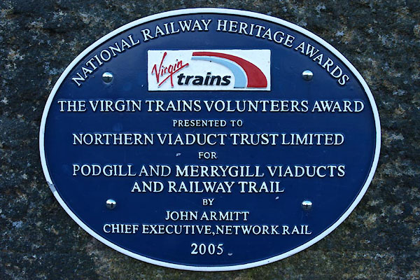 BVZ62.jpg Plaque, resoration, 2005. (taken 2.3.2012) |
||
|
|
||
 Lakes Guides menu.