 Old Cumbria Gazetteer
 |
 |
|
| pinfold, Brigham | ||
| locality:- | Brigham | |
| civil parish:- | Brigham (formerly Cumberland) | |
| county:- | Cumbria | |
| locality type:- | pinfold | |
| coordinates:- | NY09123000 | |
| 1Km square:- | NY0930 | |
| 10Km square:- | NY03 | |
| references:- | OS County Series |
|
|
|
||
 BWA28.jpg (taken 9.3.2012) |
||
|
|
||
| evidence:- | old map:- OS County Series (Cmd 54 7) |
|
| source data:- | Maps, County Series maps of Great Britain, scales 6 and 25
inches to 1 mile, published by the Ordnance Survey, Southampton,
Hampshire, from about 1863 to 1948. "Pound" |
|
|
|
||
| evidence:- | database:- Listed Buildings 2010 |
|
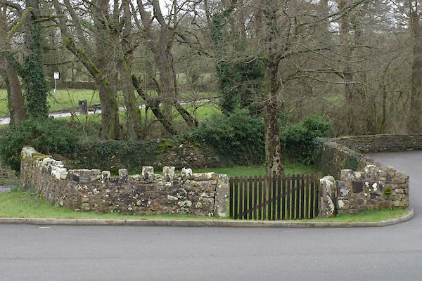
| source data:- | courtesy of English Heritage "CATTLE POUND AT HIGH ELLERBECK BRIDGE / / ELLERBECK BROW / BRIGHAM / ALLERDALE / CUMBRIA / II / 72605 / NY0913230008" |
|
| source data:- | courtesy of English Heritage "Cattle pound. Early C19. Calciferous sandstone rubble. Low drystone wall with alternative large and small stone coping, enclosing a small roughly rectangular area between a field and the former road leading to a ford over the river. Now disused and overgrown but a rare survival in this area." |
|
|
|
||
 Lakes Guides menu.