 Old Cumbria Gazetteer
 |
 |
|
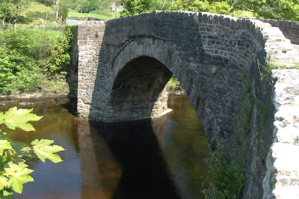
| Millthrop Bridge, Millthrop | ||
| Millthrop Bridge | ||
| site name:- | Rawthey, River | |
| locality:- | Millthrop | |
| civil parish:- | Sedbergh (formerly Yorkshire) | |
| county:- | Cumbria | |
| locality type:- | bridge | |
| coordinates:- | SD66139138 | |
| 1Km square:- | SD6691 | |
| 10Km square:- | SD69 | |
|
|
||
 BYK33.jpg (taken 31.5.2013) 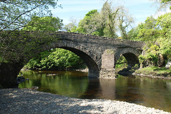 BYK34.jpg (taken 31.5.2013) |
||
|
|
||
| evidence:- | old map:- OS County Series (Yrk 63 3) placename:- Millthrop Bridge |
|
| source data:- | Maps, County Series maps of Great Britain, scales 6 and 25
inches to 1 mile, published by the Ordnance Survey, Southampton,
Hampshire, from about 1863 to 1948. |
|
|
|
||
| evidence:- | old map:- Jefferys 1770 (Wmd) |
|
| source data:- | Map, 4 sheets, The County of Westmoreland, scale 1 inch to 1
mile, surveyed 1768, and engraved and published by Thomas
Jefferys, London, 1770.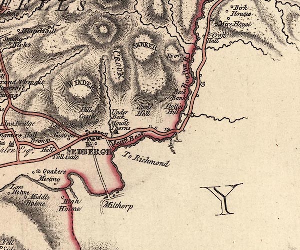 J5SD69SE.jpg double line, road, across a stream; bridge item:- National Library of Scotland : EME.s.47 Image © National Library of Scotland |
|
|
|
||
| evidence:- | database:- Listed Buildings 2010 placename:- Millthrop Bridge |
|
| source data:- | courtesy of English Heritage "MILLTHROP BRIDGE OVER RIVER RAWTHEY / / / SEDBERGH / SOUTH LAKELAND / CUMBRIA / II / 484639 / SD6614091372" |
|
| source data:- | courtesy of English Heritage "Public road bridge over River Rawthey. Probably C17; altered. Mixed random rubble. Two segmental arches of unequal span (the north shorter) with rubble voussoirs, springing from a pier which has a triangular cutwater on the east (upstream) side and a similar cutwater on the west side carried up to form a triangular refuge to the deck. Rebuilt parapets." |
|
|
|
||
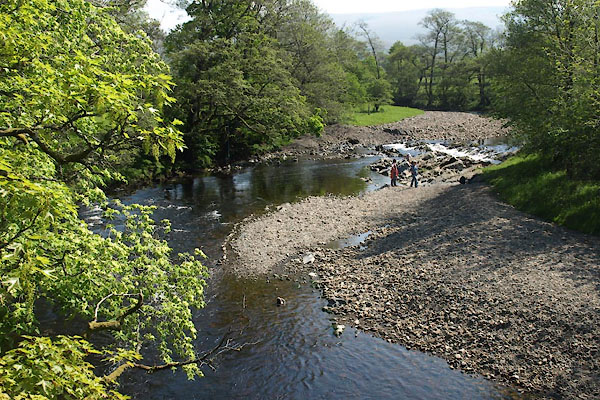 BYK35.jpg View of river. (taken 31.5.2013) |
||
|
|
||
 Lakes Guides menu.