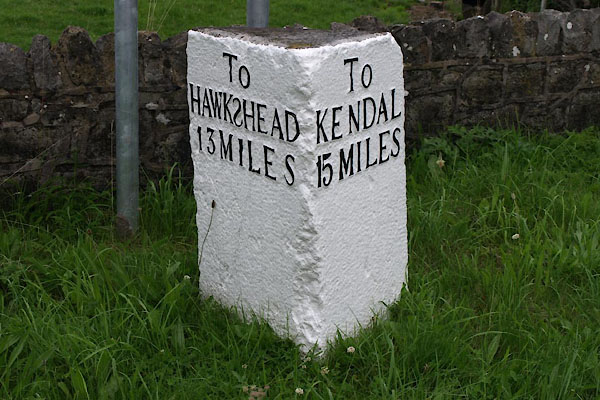


BTG13.jpg Inscribed stone, letters in relief:-
"To HAWKSHEAD 13 MILES / To KENDAL 15 MILES" (taken 30.7.2010)
"HAWKSHEAD 13 KENDAL 15 M.S."
courtesy of English Heritage
"MILESTONE APPROXIMATELY 100 METRES TO WEST OF LONGLANDS FARM / / / BROUGHTON EAST / SOUTH LAKELAND / CUMBRIA / II / 76914 / SD3890080101"
courtesy of English Heritage
"Milestone. C18. Stone. Triangular plan, with one angle removed. Left face has panel reading: "TO/HAWKSHEAD/13 MILES" (the S of Hawkshead reversed). Right face has panel reading: "TO/KENDAL/15 MILES"."

 Lakes Guides menu.