 Old Cumbria Gazetteer
 |
 |
|
| milestone, Brough (5) | ||
| site name:- | road, Bowes to Brough | |
| locality:- | Augill | |
| civil parish:- | Brough (formerly Westmorland) | |
| county:- | Cumbria | |
| locality type:- | milestone | |
| coordinates:- | NY81431472 | |
| 1Km square:- | NY8114 | |
| 10Km square:- | NY81 | |
| references:- | OS County Series |
|
|
|
||
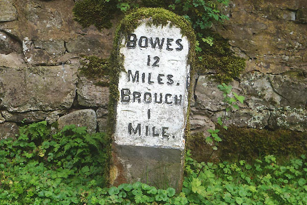 CFM99.jpg Inscribed stone:- "BOWES / 12 / MILES. / BROUGH / 1 / MILE." (taken 23.9.2016) |
||
|
|
||
| evidence:- | old map:- OS County Series (Wmd 16) |
|
| source data:- | Maps, County Series maps of Great Britain, scales 6 and 25
inches to 1 mile, published by the Ordnance Survey, Southampton,
Hampshire, from about 1863 to 1948. "M.S. BOWES 12" |
|
|
|
||
| evidence:- | possibly old map:- Jefferys 1770 (Wmd) |
|
| source data:- | Map, 4 sheets, The County of Westmoreland, scale 1 inch to 1
mile, surveyed 1768, and engraved and published by Thomas
Jefferys, London, 1770.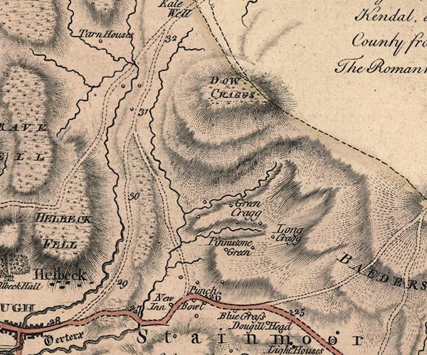 J5NY81NW.jpg "27" milestone marked by road item:- National Library of Scotland : EME.s.47 Image © National Library of Scotland |
|
|
|
||
| evidence:- | database:- Listed Buildings 2010 |
|
| source data:- | courtesy of English Heritage "MILESTONE TO SOUTH OF AUGILL HOUSE / / A66 (EAST OF BROUGH) / BROUGH / EDEN / CUMBRIA / II / 73291 / NY8144014718" |
|
| source data:- | courtesy of English Heritage "Milestone; C19. Single stone c2 ft high with segmental top and edge chamfers. Carved sans serif inscription painted out in white: BOWES 12 MILES (hand points to right), BROUGH 1 MILE (hand points to left)." |
|
|
|
||
 Lakes Guides menu.