 Old Cumbria Gazetteer
 |
 |
|
| milestone, Alston Moor (25) | ||
| site name:- | road, Alston to Hexham | |
| civil parish:- | Alston Moor (formerly Cumberland) | |
| county:- | Cumbria | |
| locality type:- | milestone | |
| coordinates:- | NY71604807 | |
| 1Km square:- | NY7148 | |
| 10Km square:- | NY74 | |
|
|
||
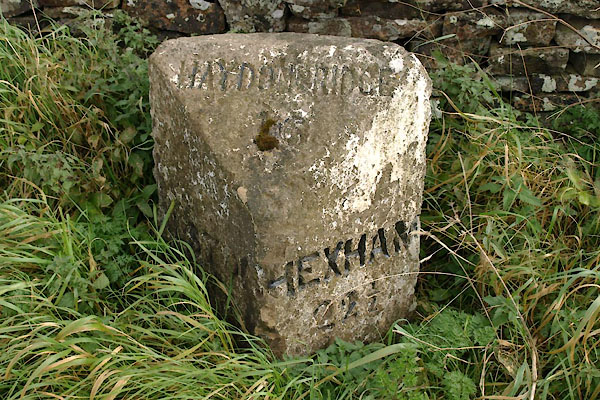 BXL14.jpg "HAYDON BRIDGE / [16]" "HEXHAM / 22½" (taken 28.9.2012) 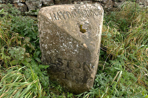 BXL15.jpg "ALSTON / 1" (taken 28.9.2012) |
||
|
|
||
| evidence:- | old map:- OS County Series (Cmd 34 2) |
|
| source data:- | Maps, County Series maps of Great Britain, scales 6 and 25
inches to 1 mile, published by the Ordnance Survey, Southampton,
Hampshire, from about 1863 to 1948. "M.S Alston .. 1 Haydon Bridge .. 16 Hexham .. 22 1/2" |
|
|
|
||
| evidence:- | database:- Listed Buildings 2010 |
|
| source data:- | courtesy of English Heritage "MILESTONE TO SOUTH WEST OF NEWSHIELD / / A686 / ALSTON MOOR / EDEN / CUMBRIA / II / 73087 / NY7161748075" |
|
| source data:- | courtesy of English Heritage "Milestone, probably C19 for Alston Turnpike Trust. Single stone c2 1/2 ft high with 2 angled front faces and angled top; painted white with carved sans-serif lettering picked out in black: HAYDON BRIDGE 16 to top, ALSTON 1 to left, and HEXHAM 22 1/2 to right." |
|
|
|
||
 Lakes Guides menu.