 Old Cumbria Gazetteer
 |
 |
|
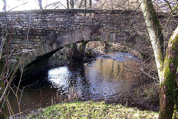
| Lupton Bridge, Lupton | ||
| Lupton Bridge | ||
| site name:- | Lupton Beck | |
| civil parish:- | Lupton (formerly Westmorland) | |
| civil parish:- | Hutton Roof (formerly Westmorland) | |
| county:- | Cumbria | |
| locality type:- | bridge | |
| coordinates:- | SD56558013 | |
| 1Km square:- | SD5680 | |
| 10Km square:- | SD58 | |
|
|
||
 BLL79.jpg (taken 16.12.2005) |
||
|
|
||
| evidence:- | old map:- OS County Series (Wmd 47 6) placename:- Lupton Bridge |
|
| source data:- | Maps, County Series maps of Great Britain, scales 6 and 25
inches to 1 mile, published by the Ordnance Survey, Southampton,
Hampshire, from about 1863 to 1948. "Lupton Bridge" |
|
|
|
||
| evidence:- | database:- Listed Buildings 2010 placename:- Lupton Bridge |
|
| source data:- | courtesy of English Heritage "LUPTON BRIDGE / / / LUPTON / SOUTH LAKELAND / CUMBRIA / II / 75698 / SD5654580150" |
|
| source data:- | courtesy of English Heritage "Bridge over Lupton Beck. Probably C18. Dressed stone. Segmental arch and straight coped parapet. 3 iron ties." |
|
|
|
||
 Lakes Guides menu.