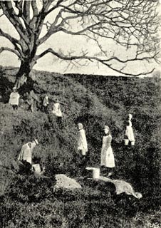


 Briggle Beck (2)
placename:- Low Well
 click to enlarge
BGG122.jpg
Included on p.67 of Lakeland and Ribblesdale, by Edmund Bogg. The text says that the well served Langwathby, the girls using a footpath crossing the Briggle Beck nearby. BUT:- "Now the smiling faces, and troops of village girls with hoop and pail, will soon cease to congregate at this spot, for this is an age of waterworks and reservoirs, and the small village of Winskill is to have constant supply of water brought to their doors and the old-time trysting place will be a thing of the past. But as one elderly native remarked to the writer: "When we du hev't watter brow't et toun, we sall still gan dune to fetch et frae t'well; hisen't it a vast mure nataral te ev t'watter pure hout et grund, than te hev it out et lead pipes." ..."
item:- JandMN : 231.22
Image © see bottom of page
