 Old Cumbria Gazetteer
 |
 |
|
| Lambert Lad, Barton | ||
| Lambert Lad | ||
| locality:- | High Street | |
| locality:- | Loadpot Hill | |
| civil parish:- | Barton (formerly Westmorland) | |
| civil parish:- | Askham (formerly Westmorland) | |
| county:- | Cumbria | |
| locality type:- | boundary stone | |
| locality type:- | parish boundary mark | |
| coordinates:- | NY45781891 | |
| 1Km square:- | NY4518 | |
| 10Km square:- | NY41 | |
|
|
||
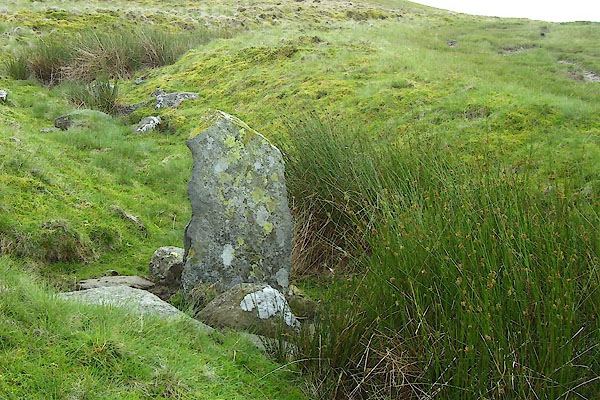 BNX21.jpg (taken 30.7.2007) 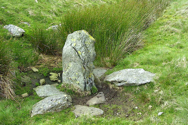 BNX22.jpg (taken 30.7.2007) |
||
|
|
||
| evidence:- | old map:- OS County Series (Wmd 13 1) placename:- Lambert Lad |
|
| source data:- | Maps, County Series maps of Great Britain, scales 6 and 25
inches to 1 mile, published by the Ordnance Survey, Southampton,
Hampshire, from about 1863 to 1948. "Lambert Lad" boundary stone |
|
|
|
||
 Lakes Guides menu.