 Old Cumbria Gazetteer
 |
 |
|
| Kirfit Hall, Casterton | ||
| Kirfit Hall | ||
| civil parish:- | Casterton (formerly Westmorland) | |
| county:- | Cumbria | |
| locality type:- | buildings | |
| coordinates:- | SD61757939 | |
| 1Km square:- | SD6179 | |
| 10Km square:- | SD67 | |
|
|
||
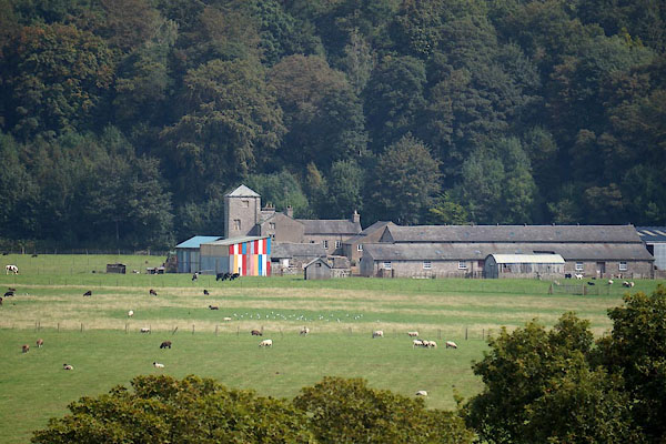 CBO91.jpg (taken 5.9.2014) |
||
|
|
||
| evidence:- | old map:- OS County Series (Wmd 47 8) placename:- Kirfit Hall |
|
| source data:- | Maps, County Series maps of Great Britain, scales 6 and 25
inches to 1 mile, published by the Ordnance Survey, Southampton,
Hampshire, from about 1863 to 1948. "Kirfit Hall" |
|
|
|
||
| evidence:- | old map:- Jefferys 1770 (Wmd) placename:- Kirk Foot |
|
| source data:- | Map, 4 sheets, The County of Westmoreland, scale 1 inch to 1
mile, surveyed 1768, and engraved and published by Thomas
Jefferys, London, 1770.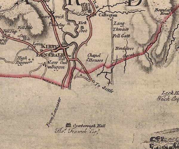 J5SD67NW.jpg "Kirk foot" house item:- National Library of Scotland : EME.s.47 Image © National Library of Scotland |
|
|
|
||
| evidence:- | database:- Listed Buildings 2010 placename:- Kirfitt Hall |
|
| source data:- | courtesy of English Heritage "KIRFITT HALL AND ATTACHED OUTBUILDING / / / CASTERTON / SOUTH LAKELAND / CUMBRIA / II / 75603 / SD6177279413" |
|
|
|
||
| notes:- |
tower |
|
| Perriam, D R &Robinson, J: 1998: Medieval Fortified Buildings of Cumbria: CWAAS::
ISBN 1 873124 23 6; illustration |
||
|
|
||
| hearsay:- |
It is said that Henry VIII stayed here when courting Catherine Parr. And, it is said
that the headless ghost of Anne Boleyn wandered the hall to disturb his dreams of
Catherine. She is still said to appear from an archway under the lane beyond the farm,
where there is a bridge over a beck. |
|
| Palmer 1945 |
||
|
|
||
 Lakes Guides menu.