 Old Cumbria Gazetteer
 |
 |
|
| Kendal Junction, Oxenholme | ||
| Kendal Junction | ||
| site name:- | Lancaster and Carlisle Railway | |
| locality:- | Oxenholme | |
| civil parish:- | Kendal (formerly Westmorland) | |
| county:- | Cumbria | |
| locality type:- | railway junction | |
| coordinates:- | SD53049001 | |
| 1Km square:- | SD5390 | |
| 10Km square:- | SD59 | |
| references:- | OS County Series |
|
|
|
||
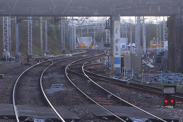 CEW68.jpg (taken 18.4.2016) |
||
|
|
||
| evidence:- | old map:- OS County Series (Wmd 39 9) placename:- Kendal junction item:- railway signal |
|
| source data:- | Maps, County Series maps of Great Britain, scales 6 and 25
inches to 1 mile, published by the Ordnance Survey, Southampton,
Hampshire, from about 1863 to 1948.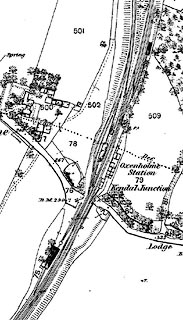 click to enlarge click to enlargeCSRY0170.jpg "Oxenholme Station / S.P. / Kendal Junction" |
|
|
|
||
 CEL92.jpg part of junction N of Burton Road bridge. (taken 1.1.2016) |
||
|
|
||
 Lakes Guides menu.