 Old Cumbria Gazetteer
 |
 |
|
| Hollow Stone, Mardale | ||
| Hollow Stone | ||
| locality:- | Mardale | |
| civil parish:- | Shap (formerly Westmorland) | |
| county:- | Cumbria | |
| locality type:- | stone | |
| coordinates:- | NY48071171 (?) | |
| 1Km square:- | NY4811 | |
| 10Km square:- | NY41 | |
| references:- | OS County Series |
|
|
|
||
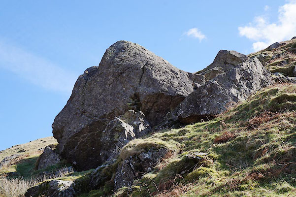 CAD75.jpg (taken 24.3.2014) 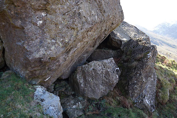 CAD76.jpg ... balanced ... propped. (taken 24.3.2014) |
||
|
|
||
| evidence:- | old map:- OS County Series (Wmd 20 6) placename:- Hollow Stone |
|
| source data:- | Maps, County Series maps of Great Britain, scales 6 and 25
inches to 1 mile, published by the Ordnance Survey, Southampton,
Hampshire, from about 1863 to 1948. |
|
|
|
||
 Lakes Guides menu.