 Old Cumbria Gazetteer
 |
 |
|
| Flimby Colliery, Maryport | ||
| Flimby Colliery | ||
| Robin Hood Pit | ||
| civil parish:- | Maryport (formerly Cumberland) | |
| county:- | Cumbria | |
| locality type:- | coal mine | |
| locality type:- | mine | |
| coordinates:- | NY04033368 (about) | |
| 1Km square:- | NY0433 | |
| 10Km square:- | NY03 | |
| references:- | OS County Series |
|
|
|
||
| evidence:- | old map:- OS County Series (Cmd 45 13) placename:- Flimby Colliery placename:- Robin Hood Pit |
|
| source data:- | Maps, County Series maps of Great Britain, scales 6 and 25
inches to 1 mile, published by the Ordnance Survey, Southampton,
Hampshire, from about 1863 to 1948. "Flimby Colliery (Robin Hood Pit)" tramroad to railway at coast |
|
|
|
||
| evidence:- | old text:- Postlethwaite 1877 (3rd edn 1913) placename:- Robin Hood Pit item:- coal |
|
| source data:- | Book, Mines and Mining in the English Lake District, by John Postlethwaite, Keswick,
published by W H Moss and Sons, Whitehaven, Cumberland now Cumbria, 1877; published
1877-1913. goto source goto sourcepage 148:- "... The Main Band seam is looked upon by geologists as the most interesting, because it is found to contain a splendid series of fossil flora, some of which prove this coalfield to be of "Middle Coal Measure Age." These examples of beautiful vegetable life are embedded in the roof shales just above the coal. There are examples of large sigillaria, 20ft. long, lying in the same shale beds as the most delicate "Sphenopteris furcata," "Sphenopteris" goto sourcepage 150:- "obtusiloba," and "Zeilleria delicatula." More beautiful flora could hardly be found in our best ferneries today. There are 22 varieties of flora found in this coalfield, mostly on the horizon of the Main Band." "Mr. Newell Arber, M.A., F.G.S., Cambridge, collected no fewer than 15 of these in one locality in the Robin Hood Pit, belonging to the Flimby Colliery Company, and states that "The occurrence of 'Zeilleria delicatula,' a plant confined to the Middle Coal Measures, places without doubt this coalfield in that age." ..." |
|
|
|
||
| evidence:- | possibly old map:- Postlethwaite 1877 (3rd edn 1913) |
|
| source data:- | Map, uncoloured engraving, Map of the Lake District Mining Field, Westmorland, Cumberland,
Lancashire, scale about 5 miles to 1 inch, by John Postlethwaite, published by W H
Moss and Sons, 13 Lowther Street, Whitehaven, Cumberland, 1877 edn 1913.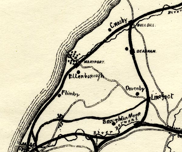 PST2NY03.jpg "Flimby" mine symbol, by Flimby item:- JandMN : 162.2 Image © see bottom of page |
|
|
|
||
Lakes Guides menu.