 Old Cumbria Gazetteer
 |
 |
|
| Cark Bridge, Staveley-in-Cartmel | ||
| Cark Bridge | ||
| site name:- | Ayside Pool | |
| civil parish:- | Staveley-in-Cartmel (formerly Lancashire) | |
| county:- | Cumbria | |
| locality type:- | bridge | |
| coordinates:- | SD38538250 | |
| 1Km square:- | SD3882 | |
| 10Km square:- | SD38 | |
|
|
||
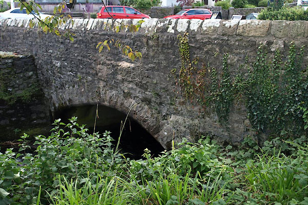 BXJ96.jpg (taken 21.9.2012) 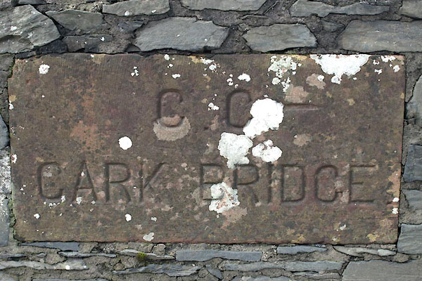 BXJ97.jpg Plaque:- "C.C. / CARK BRIDGE" (taken 21.9.2012) |
||
|
|
||
| evidence:- | old map:- OS County Series (Lan 12 7) placename:- Cark Bridge |
|
| source data:- | Maps, County Series maps of Great Britain, scales 6 and 25
inches to 1 mile, published by the Ordnance Survey, Southampton,
Hampshire, from about 1863 to 1948. |
|
|
|
||
 Lakes Guides menu.