 Old Cumbria Gazetteer
 |
 |
|
| Burton Hall, Burton-in-Kendal | ||
| Burton Hall | ||
| Street:- | Tanpits Lane | |
| locality:- | Burton-in-Kendal | |
| civil parish:- | Burton-in-Kendal (formerly Westmorland) | |
| county:- | Cumbria | |
| locality type:- | buildings | |
| coordinates:- | SD52967671 | |
| 1Km square:- | SD5276 | |
| 10Km square:- | SD57 | |
|
|
||
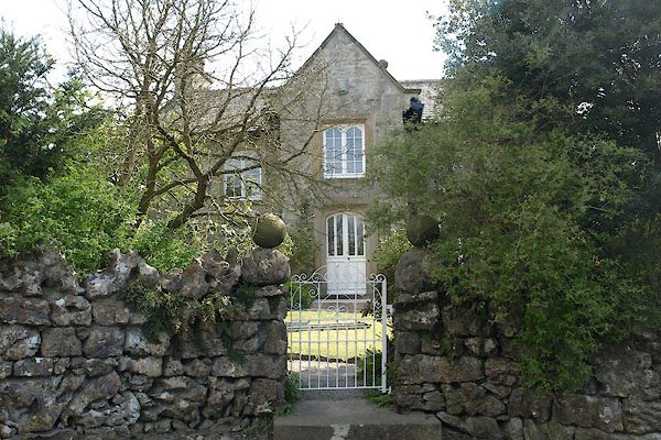 BWJ11.jpg (taken 6.5.2012) 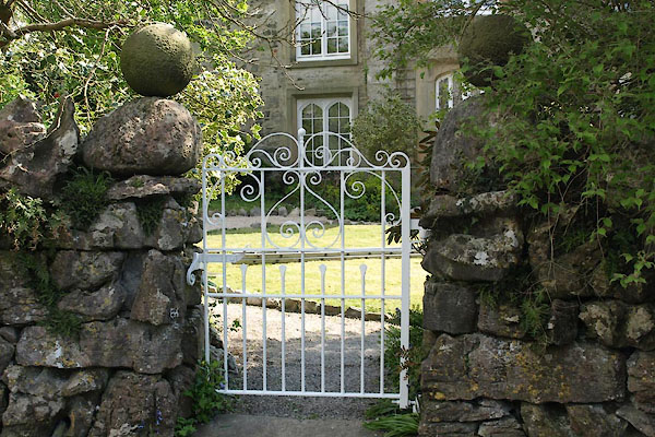 BWJ12.jpg Gate. (taken 6.5.2012) |
||
|
|
||
| evidence:- | old map:- OS County Series (Wmd 47 13) placename:- Burton Hall |
|
| source data:- | Maps, County Series maps of Great Britain, scales 6 and 25
inches to 1 mile, published by the Ordnance Survey, Southampton,
Hampshire, from about 1863 to 1948. |
|
|
|
||
| evidence:- | database:- Listed Buildings 2010 placename:- Burton Hall |
|
| source data:- | courtesy of English Heritage "BURTON HALL / / TANPITS LANE / BURTON IN KENDAL / SOUTH LAKELAND / CUMBRIA / II / 76667 / SD5296676717" |
|
|
|
||
| evidence:- | database:- Listed Buildings 2010 |
|
| source data:- | courtesy of English Heritage "COACH HOUSE, STABLES AND HAYLOFT CIRCA 4 METRES SOUTH OF BURTON HALL / / TANPITS LANE / BURTON IN KENDAL / SOUTH LAKELAND / CUMBRIA / II / 76668 / SD5297676702" |
|
|
|
||
| evidence:- | database:- Listed Buildings 2010 |
|
| source data:- | courtesy of English Heritage "PRIVIES CIRCA 10 METRES SOUTH OF BURTON HALL / / TANPITS LANE / BURTON IN KENDAL / SOUTH LAKELAND / CUMBRIA / II / 76669 / SD5296176695" |
|
| source data:- | courtesy of English Heritage "Privies. Probably mid C19. Stone rubble with graduated greenslate roof. Entrances either side of wall dividing stable yard from garden: said to be for workers and gentry respectively. Entrance from stable yard has plain board door with flat lintel. Entrance from garden has pointed-arched head with voussoirs and decoratively-studded board door." |
|
|
|
||
 Lakes Guides menu.