 Old Cumbria Gazetteer
 |
 |
|
| Broughton Hall, Wood Broughton | ||
| Broughton Hall | ||
| locality:- | Wood Broughton | |
| civil parish:- | Broughton East (formerly Lancashire) | |
| county:- | Cumbria | |
| locality type:- | buildings | |
| coordinates:- | SD37878097 | |
| 1Km square:- | SD3780 | |
| 10Km square:- | SD38 | |
|
|
||
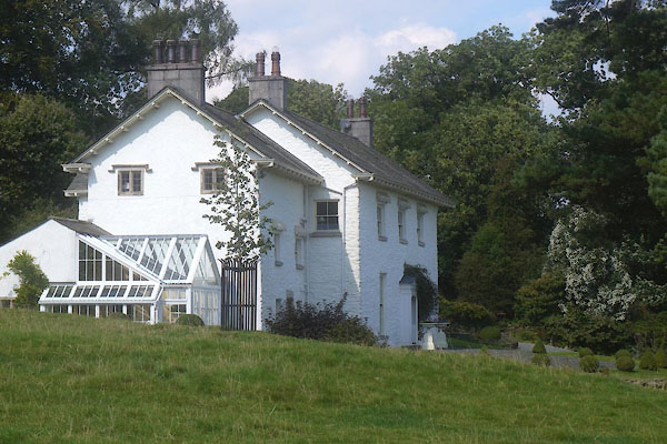 CDW95.jpg (taken 11.9.2015) |
||
|
|
||
| evidence:- | old map:- OS County Series (Lan 12 11) placename:- Broughton Hall |
|
| source data:- | Maps, County Series maps of Great Britain, scales 6 and 25
inches to 1 mile, published by the Ordnance Survey, Southampton,
Hampshire, from about 1863 to 1948. |
|
|
|
||
| evidence:- | database:- Listed Buildings 2010 placename:- Broughton Hall |
|
| source data:- | courtesy of English Heritage "BROUGHTON HALL / / / BROUGHTON EAST / SOUTH LAKELAND / CUMBRIA / II / 76912 / SD3788080975" |
|
|
|
||
| notes:- |
site of a hall |
|
| Perriam, D R &Robinson, J: 1998: Medieval Fortified Buildings of Cumbria: CWAAS::
ISBN 1 873124 23 6 |
||
|
|
||
 Lakes Guides menu.