 Old Cumbria Gazetteer
 |
 |
|
| Bridge End Bridge, Broughton West | ||
| Bridge End Bridge | ||
| site name:- | Kirkby Pool | |
| civil parish:- | Broughton West (formerly Lancashire) | |
| civil parish:- | Kirkby Ireleth (formerly Lancashire) | |
| county:- | Cumbria | |
| locality type:- | bridge | |
| coordinates:- | SD24419033 | |
| 1Km square:- | SD2490 | |
| 10Km square:- | SD29 | |
|
|
||
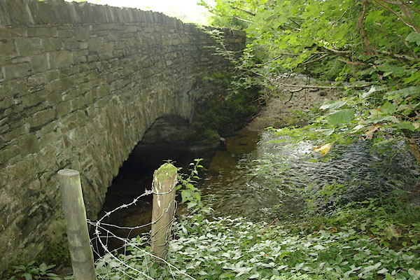 BTK16.jpg (taken 25.8.2010) 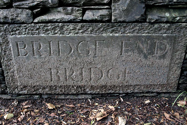 BTK17.jpg Plaque:- "BRIDGE END / BRIDGE" (taken 25.8.2010) |
||
|
|
||
| evidence:- | old map:- OS County Series (Lan 7 5) placename:- Bridge End Bridge |
|
| source data:- | Maps, County Series maps of Great Britain, scales 6 and 25
inches to 1 mile, published by the Ordnance Survey, Southampton,
Hampshire, from about 1863 to 1948. |
|
|
|
||
| evidence:- | old map:- OS County Series (Lan 7) placename:- Bridge End Bridge |
|
| source data:- | Maps, County Series maps of Great Britain, scales 6 and 25
inches to 1 mile, published by the Ordnance Survey, Southampton,
Hampshire, from about 1863 to 1948. "Bridge End Bridge" |
|
|
|
||
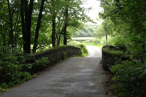 BTK15.jpg (taken 25.8.2010) |
||
|
|
||
 Lakes Guides menu.