 Old Cumbria Gazetteer
 |
 |
|
| Bolton-le-Sands Station, Lancashire | ||
| Bolton-le-Sands Station | ||
| Bolton Station | ||
| site name:- | Lancaster and Carlisle Railway | |
| locality:- | Bolton-le-Sands | |
| county:- | Lancashire | |
| locality type:- | railway station (gone) | |
| coordinates:- | SD47986825 | |
| 1Km square:- | SD4768 | |
| 10Km square:- | SD46 | |
| SummaryText:- | Opened as Bolton Station 1850; renamed Bolton-le-Sands 1861; closed 1969. | |
|
|
||
| evidence:- | old map:- Garnett 1850s-60s H |
|
| source data:- | Map of the English Lakes, in Cumberland, Westmorland and
Lancashire, scale about 3.5 miles to 1 inch, published by John
Garnett, Windermere, Westmorland, 1850s-60s.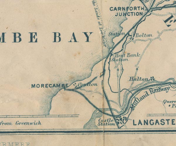 GAR2SD46.jpg "Station" dot by railway item:- JandMN : 82.1 Image © see bottom of page |
|
|
|
||
 Lakes Guides menu.