 Old Cumbria Gazetteer
 |
 |
|
| Blackpool Gate Bridge, Bewcastle | ||
| Blackpool Gate Bridge | ||
| Blackpoolgate Bridge | ||
| site name:- | Black Lyne | |
| locality:- | Blackpool Gate | |
| civil parish:- | Bewcastle (formerly Cumberland) | |
| county:- | Cumbria | |
| locality type:- | bridge | |
| coordinates:- | NY53257774 | |
| 1Km square:- | NY5377 | |
| 10Km square:- | NY57 | |
|
|
||
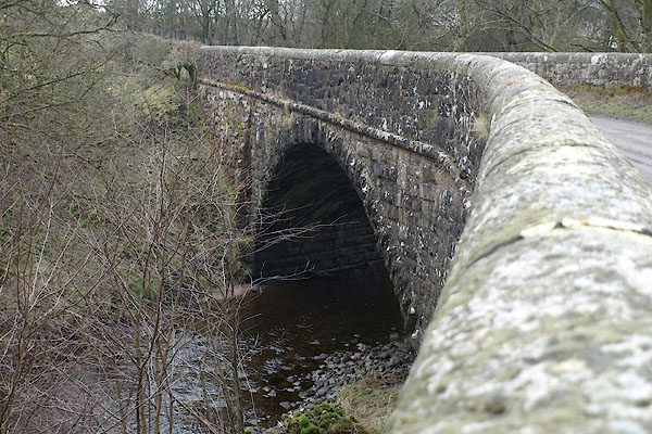 BSE57.jpg (taken 19.2.2010) 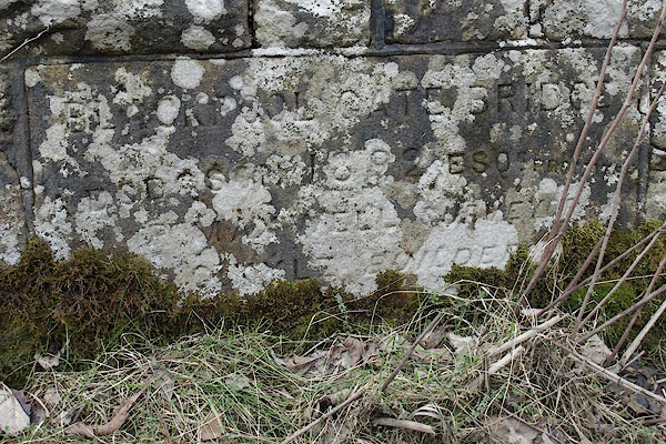 BSE58.jpg Plaque:- "BLACKPOOL GATE BRIDGE / A. DODSON 1892 ESQ[R] PROMOTER / [ ]MA[ ]ELL SURVEYOR / [ Y]LE BUILDER" (taken 19.2.2010) |
||
|
|
||
| evidence:- | old map:- OS County Series (Cmd 4 13) |
|
| source data:- | Maps, County Series maps of Great Britain, scales 6 and 25
inches to 1 mile, published by the Ordnance Survey, Southampton,
Hampshire, from about 1863 to 1948. "Ford" at Black Pool and a corresponding road layout |
|
|
|
||
| evidence:- | old map:- Bell 1892 placename:- Blackpoolgate Bridge |
|
| source data:- | Map, colour lithograph, Road Map of Cumberland, by George Joseph
Bell, scale about 2.5 miles to 1 inch, printed by Charles
Thurnam and Sons, Carlisle, Cumberland, 1892.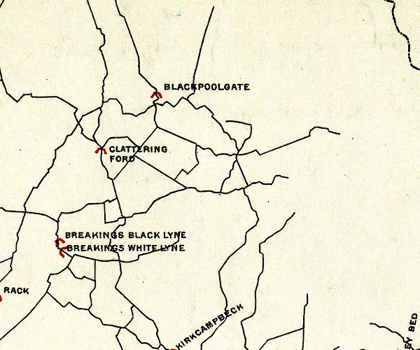 BEL9NY57.jpg "BLACKPOOLGATE" bridge symbol Road map of Cumberland showing County Bridges item:- Carlisle Library : Map 38 Image © Carlisle Library |
|
|
|
||
 Lakes Guides menu.