 Old Cumbria Gazetteer
 |
 |
|
| Anthorn Bridge, Anthorn | ||
| Anthorn Bridge | ||
| locality:- | Anthorn | |
| civil parish:- | Bowness (formerly Cumberland) | |
| county:- | Cumbria | |
| locality type:- | bridge | |
| coordinates:- | NY19505823 | |
| 1Km square:- | NY1958 | |
| 10Km square:- | NY15 | |
|
|
||
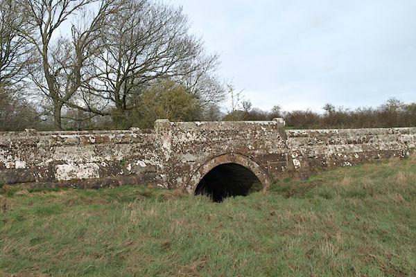 BUI15.jpg (taken 3.4.2011) 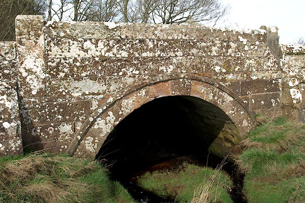 BUI16.jpg (taken 3.4.2011) |
||
|
|
||
| evidence:- | old map:- OS County Series (Cmd 14 15) placename:- Anthorn Bridge |
|
| source data:- | Maps, County Series maps of Great Britain, scales 6 and 25
inches to 1 mile, published by the Ordnance Survey, Southampton,
Hampshire, from about 1863 to 1948. |
|
|
|
||
| evidence:- | old map:- Bell 1892 placename:- Anthorn Bridge |
|
| source data:- | Map, colour lithograph, Road Map of Cumberland, by George Joseph
Bell, scale about 2.5 miles to 1 inch, printed by Charles
Thurnam and Sons, Carlisle, Cumberland, 1892.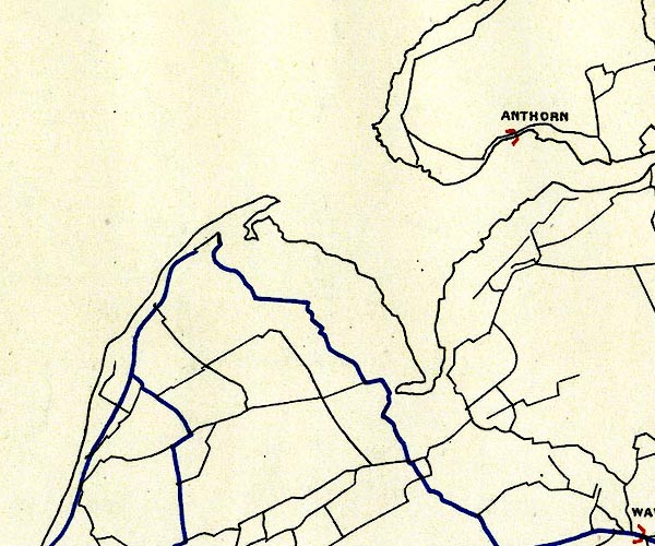 BEL9NY15.jpg "ANTHORN" bridge symbol Road map of Cumberland showing County Bridges item:- Carlisle Library : Map 38 Image © Carlisle Library |
|
|
|
||
| MN photo:- |
The beck at the bridge. |
|
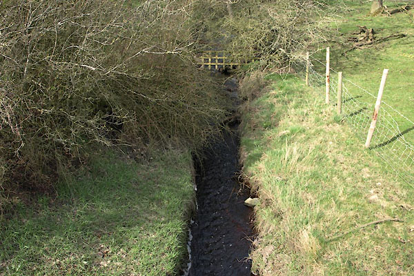 BUI18.jpg (taken 3.4.2011) 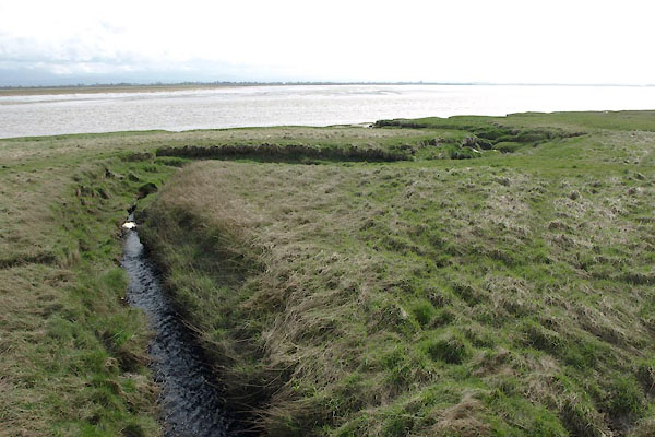 BUI17.jpg (taken 3.4.2011) |
||
|
|
||
 Lakes Guides menu.