 Old Cumbria Gazetteer
 |
 |
|
| Barbon Beacon, Middleton | ||
| Barbon Beacon | ||
| locality:- | Thorn Moor | |
| locality:- | Barbon Fell | |
| civil parish:- | Middleton (formerly Westmorland) | |
| county:- | Cumbria | |
| locality type:- | beacon | |
| locality type:- | tower | |
| coordinates:- | SD64068340 (guess) | |
| 1Km square:- | SD6483 | |
| 10Km square:- | SD68 | |
|
|
||
| evidence:- | old map:- Jefferys 1770 (Wmd) placename:- Barbon Beacon |
|
| source data:- | Map, 4 sheets, The County of Westmoreland, scale 1 inch to 1
mile, surveyed 1768, and engraved and published by Thomas
Jefferys, London, 1770.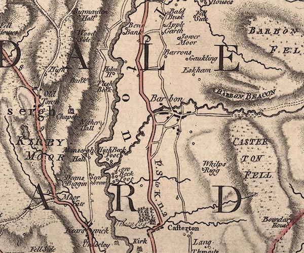 J5SD68SW.jpg "BARBON BEACON" hill hachuring; hill or mountain; tower at the west end item:- National Library of Scotland : EME.s.47 Image © National Library of Scotland |
|
|
|
||
| evidence:- | old map:- Cary 1789 (edn 1805) placename:- Barbon Beacon |
|
| source data:- | Map, uncoloured engraving, Westmoreland, scale about 2.5 miles
to 1 inch, by John Cary, London, 1789; edition 1805.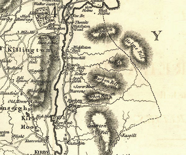 CY24SD68.jpg "Barbon Beacon" hill hachuring item:- JandMN : 129 Image © see bottom of page |
|
|
|
||
| evidence:- | old map:- Greenwood 1824 |
|
| source data:- | Maps, Map of the County of Westmorland, scale about 1 inch to 1
mile, and Map of the County of Cumberland, scale about 1 inch to
1 mile, etc, by C and J Greenwood, published by George Pringle
jnr, 70 Queen Street, Cheapside, London, 1823 and 1824
respectively. "Beacon tower at the west end of 'Barbon Fell'" |
|
|
|
||
 Lakes Guides menu.