 Old Cumbria Gazetteer
 |
 |
|
| Rampside Hall, Rampside | ||
| Rampside Hall | ||
| locality:- | Rampside | |
| civil parish:- | Barrow-in-Furness (formerly Lancashire) | |
| county:- | Cumbria | |
| locality type:- | buildings | |
| coordinates:- | SD24076630 | |
| 1Km square:- | SD2466 | |
| 10Km square:- | SD26 | |
|
|
||
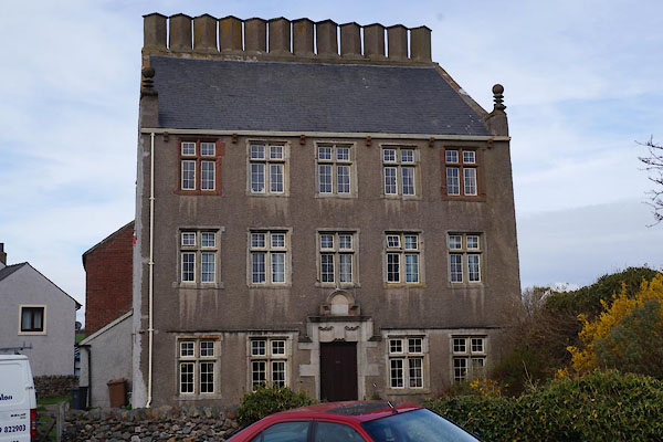 CAG26.jpg (taken 4.4.2014) 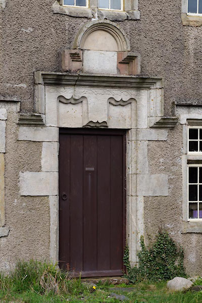 CAG27.jpg Door. (taken 4.4.2014) |
||
|
|
||
| evidence:- | old map:- OS County Series (Lan 28 1) placename:- Rampside Hall |
|
| source data:- | Maps, County Series maps of Great Britain, scales 6 and 25
inches to 1 mile, published by the Ordnance Survey, Southampton,
Hampshire, from about 1863 to 1948. |
|
|
|
||
| evidence:- | database:- Listed Buildings 2010 placename:- Rampside Hall |
|
| source data:- | courtesy of English Heritage "RAMPSIDE HALL / 101 / RAMPSIDE / BARROW IN FURNESS / BARROW IN FURNESS / CUMBRIA / I / 388561 / SD2407966307" |
|
|
|
||
| story:- |
It is claimed that in the 16th century a young man was told by the father of his lady
love, that he could only marry her when he had built a house with twelve chimneys.
So he did, and they lived happily ever after. The 12 chimneys were set up along the
roof ridge, and smoke was seen coming out of them every wedding anniversary. |
|
|
|
||
 Lakes Guides menu.