 Old Cumbria Gazetteer
 |
 |
|
| Joestown Bridge, Alstonby | ||
| locality:- | Alstonby | |
| civil parish:- | Kirklinton Middle (formerly Cumberland) | |
| civil parish:- | Westlinton (formerly Cumberland) | |
| county:- | Cumbria | |
| locality type:- | bridge | |
| coordinates:- | NY40596459 | |
| 1Km square:- | NY4064 | |
| 10Km square:- | NY46 | |
|
|
||
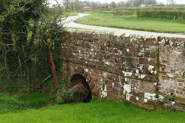 BQJ67.jpg (taken 11.4.2009) 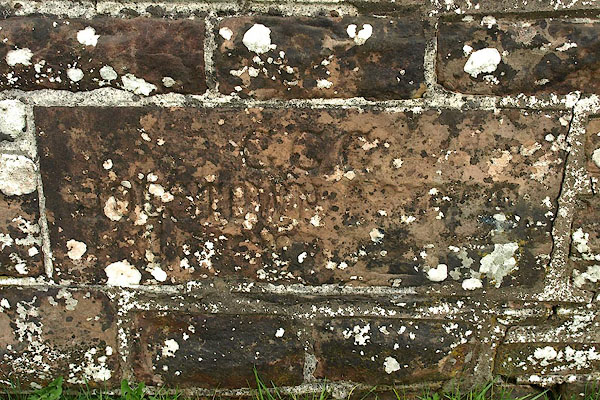 BQJ68.jpg Plaque on north parapet:- "C.C.C. / JOESTOWN BRIDGE / [ ]" (taken 11.4.2009) |
||
| Alstony Grange used to be called Joestown. |
||
|
|
||
| evidence:- | old map:- Bell 1892 placename:- Joycestown Bridge |
|
| source data:- | Map, colour lithograph, Road Map of Cumberland, by George Joseph
Bell, scale about 2.5 miles to 1 inch, printed by Charles
Thurnam and Sons, Carlisle, Cumberland, 1892.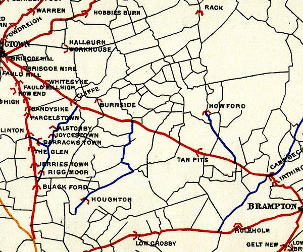 BEL9NY46.jpg "JOYCESTOWN" bridge symbol Road map of Cumberland showing County Bridges item:- Carlisle Library : Map 38 Image © Carlisle Library |
|
|
|
||
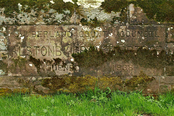 BQJ69.jpg Plaque on south parapet:- "CUMBERLAND COUNTY COUNCIL / ALSTONBY GRANGE BRIDGE / WIDENED 1938" (taken 11.4.2009) |
||
|
|
||
 Lakes Guides menu.