 Old Cumbria Gazetteer
 |
 |
|
| included in:- |
 St Mary, Gilcrux St Mary, Gilcrux |
|
| sundial, Gilcrux | ||
| site name:- | St Mary's Church | |
| locality:- | Gilcrux | |
| civil parish:- | Gilcrux (formerly Cumberland) | |
| county:- | Cumbria | |
| locality type:- | sundial | |
| coordinates:- | NY11733817 | |
| 1Km square:- | NY1138 | |
| 10Km square:- | NY13 | |
|
|
||
| MN photo:- |
The sundial is a south facing vertical dial for latitude 54d 30m (?). Gilcrux is about
54d 43.6m N; the dial is out of its planned place, perhaps moved, which might also
explain why it has had to be set at an angle here. |
|
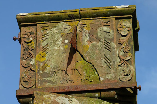 BOU13.jpg Sundial, marked for:- "LAT: 54[-30]" (taken 14.3.2008) |
||
|
|
||
| MN photo:- |
I notice that there was a William Parsable, incumbent at Borrowdale church, 1806-39;
and Borrowdale is 54d 31m N. |
|
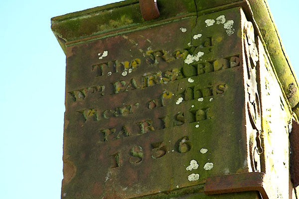 BOU15.jpg Inscription:- "The Revd. / WM. PARSABLE / Vicar of this / PARISH / 1836" (taken 14.3.2008) 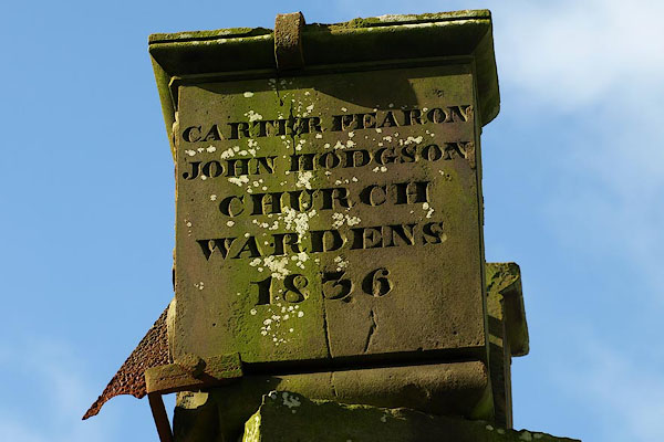 BOU14.jpg Inscription:- "CARTER [F]EARON / JOHN HODGSON / CHURCH / WARDENS / 1836" (taken 14.3.2008) |
||
|
|
||
| notes:- |
Cumbrian Sundials database, R Sylvester, 29.5.2008:- |
|
| "Gilcrux / Near Maryport. St. Mary's church above porch / Box-like. Clamped" |
||
| made 1836 |
||
| British Sundial Society reference number 216 |
||
|
|
||
Lakes Guides menu.