 Old Cumbria Gazetteer
 |
 |
|
| Yewcrag Quarries, Borrowdale | ||
| Yewcrag Quarries | ||
| Yew Crag Quarry | ||
| Blockley's Level | ||
| Fisher's Quarry | ||
| Quey Foot Quarry | ||
| New Quarry | ||
| Sam New Quarry | ||
| site name:- | Honister Slate Quarry | |
| civil parish:- | Borrowdale (formerly Cumberland) | |
| county:- | Cumbria | |
| locality type:- | slate quarry (disused) | |
| locality type:- | quarry (disused) | |
| coordinates:- | NY22351434 (etc) | |
| 1Km square:- | NY2214 | |
| 10Km square:- | NY21 | |
| SummaryText:- | several quarries | |
|
|
||
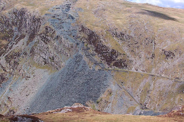 BSU24.jpg (taken 17.5.2010) |
||
|
|
||
| evidence:- | old map:- OS County Series (Cmd 69) placename:- Yewcrag Quarries |
|
| source data:- | Maps, County Series maps of Great Britain, scales 6 and 25
inches to 1 mile, published by the Ordnance Survey, Southampton,
Hampshire, from about 1863 to 1948. "Yewcrag Quarries" |
|
|
|
||
| evidence:- | old map:- Donald 1774 (Cmd) |
|
| source data:- | Map, hand coloured engraving, 3x2 sheets, The County of Cumberland, scale about 1
inch to 1 mile, by Thomas Donald, engraved and published by Joseph Hodskinson, 29
Arundel Street, Strand, London, 1774.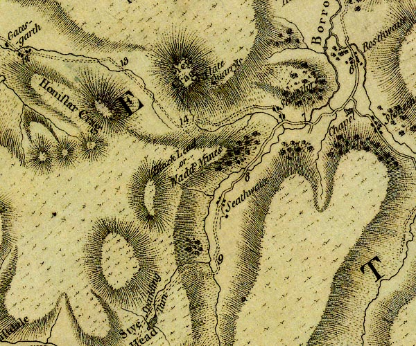 D4NY21SW.jpg "Slate Quarrys" no symbol item:- Carlisle Library : Map 2 Image © Carlisle Library |
|
|
|
||
| evidence:- | old map:- Postlethwaite 1877 (3rd edn 1913) placename:- Yew Crag Quarry |
|
| source data:- | Map, uncoloured engraving, Map of the Lake District Mining Field, Westmorland, Cumberland,
Lancashire, scale about 5 miles to 1 inch, by John Postlethwaite, published by W H
Moss and Sons, 13 Lowther Street, Whitehaven, Cumberland, 1877 edn 1913.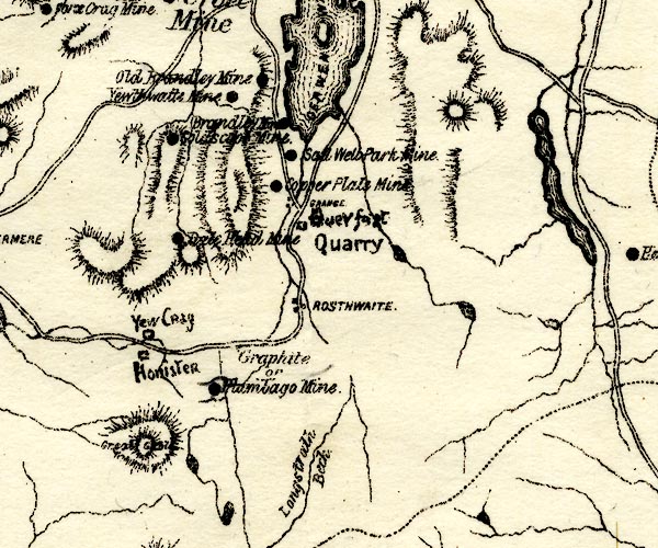 PST2NY21.jpg "Yew Crag" quarry symbol item:- JandMN : 162.2 Image © see bottom of page |
|
|
|
||
| evidence:- | old print:- Postlethwaite 1877 placename:- Yew Crag Quarry |
|
| source data:- | Print, halftone photograph, Honister and Yew Crag Quarries, Borrowdale, Cumberland,
published by W H Moss and Sons, 13 Lowther Street, Whitehaven, Cumberland, 1877 edn
1913.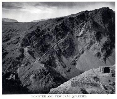 click to enlarge click to enlargePST334.jpg Tipped in opposite p.132 of Mines and Mining in the English Lake District, by John Postlethwaite. printed, bottom "HONISTER AND YEW CRAG QUARRIES." item:- JandMN : 162.36 Image © see bottom of page |
|
|
|
||
| evidence:- | old map:- Postlethwaite 1877 (3rd edn 1913) placename:- Yew Crag Quarry |
|
| source data:- | Map, uncoloured engraving, Map of the Lake District Mining Field, Westmorland, Cumberland,
Lancashire, scale about 5 miles to 1 inch, by John Postlethwaite, published by W H
Moss and Sons, 13 Lowther Street, Whitehaven, Cumberland, 1877 edn 1913. PST2NY21.jpg "Yew Crag" quarry symbol item:- JandMN : 162.2 Image © see bottom of page |
|
|
|
||
| evidence:- | old print:- Postlethwaite 1877 placename:- Yew Crag Quarry |
|
| source data:- | Print, halftone photograph, Honister and Yew Crag Quarries, Borrowdale, Cumberland,
published by W H Moss and Sons, 13 Lowther Street, Whitehaven, Cumberland, 1877 edn
1913. click to enlarge PST334.jpg Tipped in opposite p.132 of Mines and Mining in the English Lake District, by John Postlethwaite. printed, bottom "HONISTER AND YEW CRAG QUARRIES." item:- JandMN : 162.36 Image © see bottom of page |
|
|
|
||
| MN photo:- |
While there is little to see from the road, there are a lot of workings up the hill.
These pictures are taken on a walk through the area. |
|
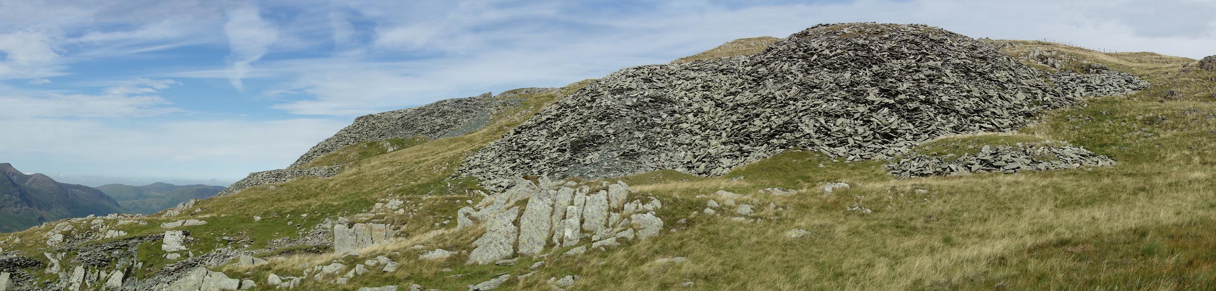 Click to enlarge BZG29.jpg (taken 6.9.2013) 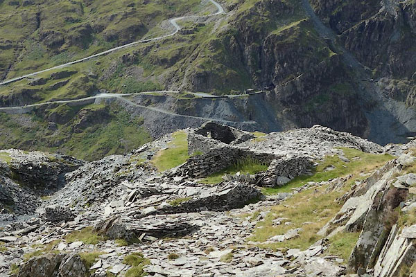 BZG30.jpg (taken 6.9.2013) 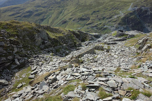 BZG31.jpg (taken 6.9.2013) 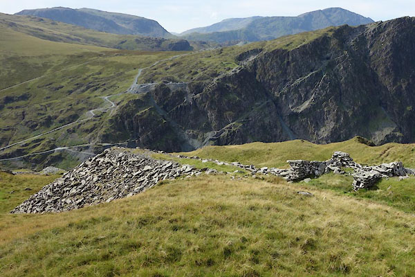 BZG32.jpg (taken 6.9.2013) 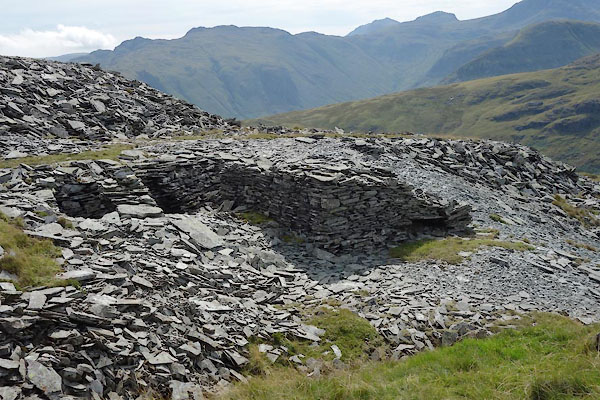 BZG33.jpg (taken 6.9.2013) 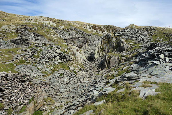 BZG34.jpg (taken 6.9.2013) 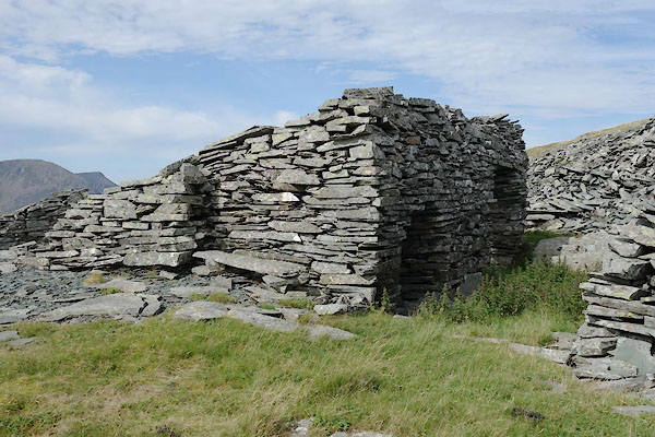 BZG35.jpg (taken 6.9.2013) 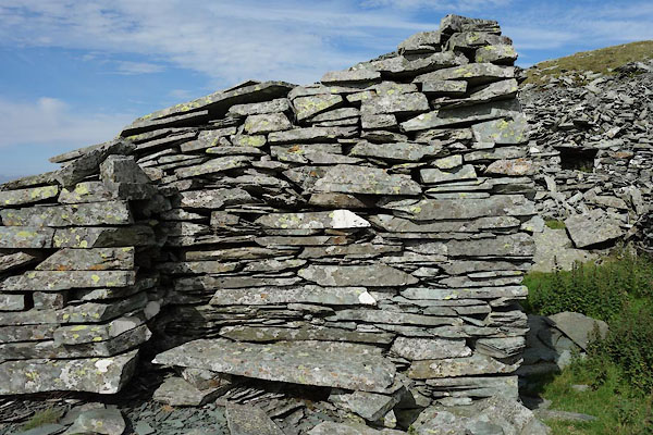 BZG36.jpg (taken 6.9.2013) 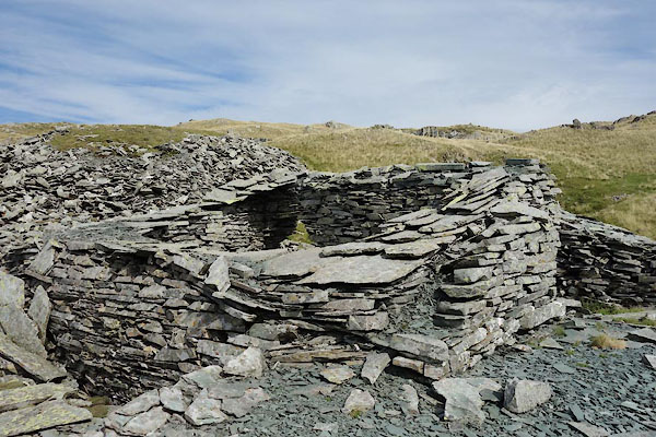 BZG37.jpg (taken 6.9.2013) 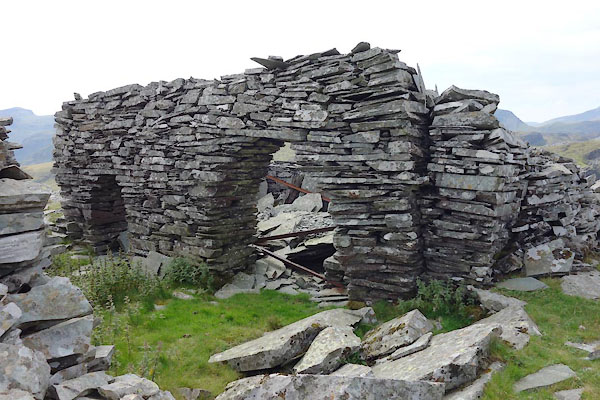 BZG38.jpg (taken 6.9.2013) 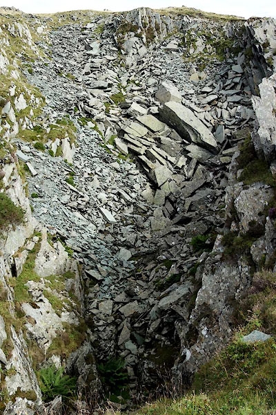 BZG39.jpg (taken 6.9.2013) 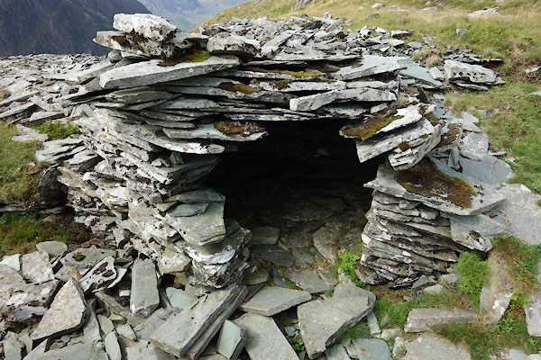 BZG40.jpg (taken 6.9.2013) 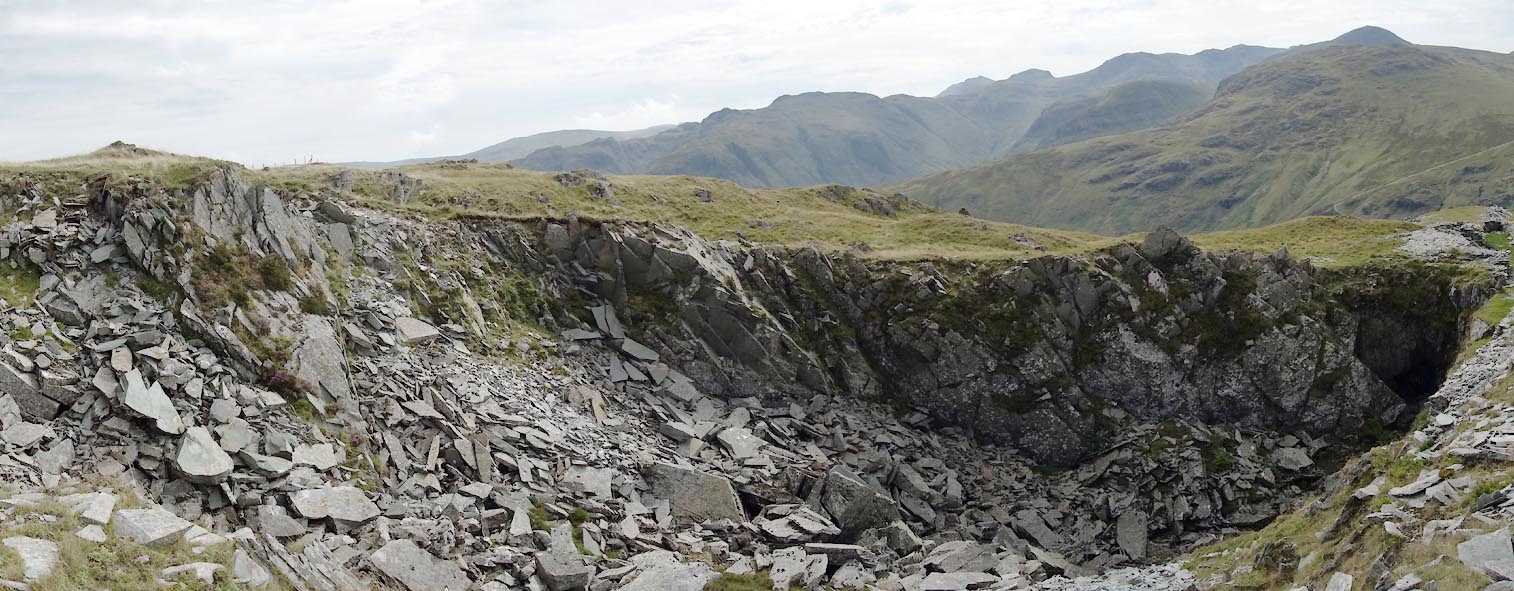 Click to enlarge BZG41.jpg (taken 6.9.2013) 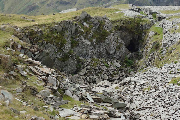 BZG42.jpg (taken 6.9.2013) |
||
|
|
||
| Glover, David: 2014: Quarries of Lakeland: Bookcase (Carlisle, Cumbria) |
||
|
|
||
 Lakes Guides menu.