 Old Cumbria Gazetteer
 |
 |
|
| Whitrigg Bridge, Whitrigg | ||
| Whitrigg Bridge | ||
| site name:- | Waver, River | |
| locality:- | Whitrigg | |
| civil parish:- | Kirkbride (formerly Cumberland) | |
| civil parish:- | Aikton (formerly Cumberland) | |
| county:- | Cumbria | |
| locality type:- | bridge | |
| coordinates:- | NY22825761 | |
| 1Km square:- | NY2257 | |
| 10Km square:- | NY25 | |
|
|
||
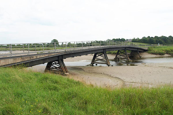 BPN52.jpg (taken 26.7.2008) 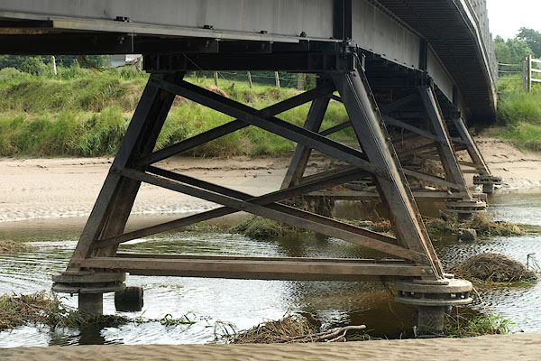 BPN53.jpg (taken 26.7.2008) |
||
|
|
||
| evidence:- | probably old map:- Donald 1774 (Cmd) |
|
| source data:- | Map, hand coloured engraving, 3x2 sheets, The County of Cumberland, scale about 1
inch to 1 mile, by Thomas Donald, engraved and published by Joseph Hodskinson, 29
Arundel Street, Strand, London, 1774.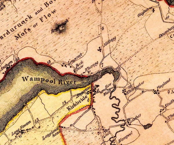 D4NY25NW.jpg ford north of Kirkbride item:- Carlisle Library : Map 2 Image © Carlisle Library |
|
|
|
||
 Lakes Guides menu.