 Old Cumbria Gazetteer
 |
 |
|
| Stockbridge, Nether Staveley | ||
| Stockbridge | ||
| locality:- | Staveley | |
| civil parish:- | Nether Staveley (formerly Westmorland) | |
| county:- | Cumbria | |
| locality type:- | bridge (?) | |
| coordinates:- | SD47359779 | |
| 1Km square:- | SD4797 | |
| 10Km square:- | SD49 | |
| SummaryText:- | Bridges under two roads | |
| references:- | OS County Series |
|
|
|
||
| evidence:- | old map:- Ford 1839 map placename:- Stoke Bridge |
|
| source data:- | Map, uncoloured engraving, Map of the Lake District of
Cumberland, Westmoreland and Lancashire, scale about 3.5 miles
to 1 inch, published by Charles Thurnam, Carlisle, and by R
Groombridge, 5 Paternoster Row, London, 3rd edn 1843.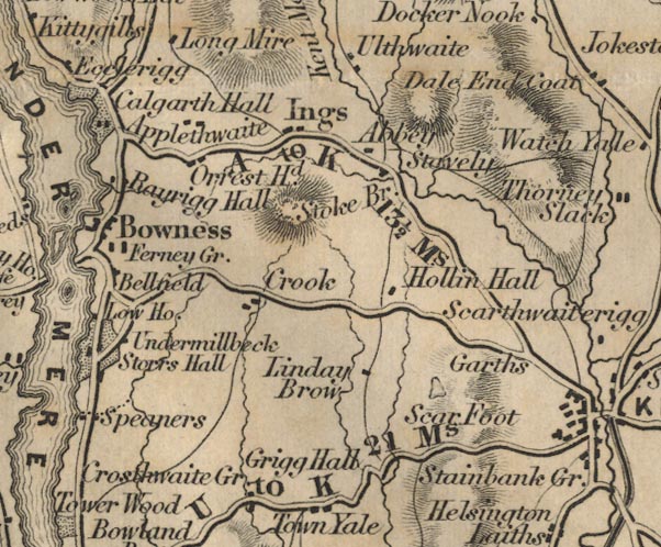 FD02SD49.jpg "Stoke Br." Road across stream? item:- JandMN : 100.1 Image © see bottom of page |
|
|
|
||
 Lakes Guides menu.