 Old Cumbria Gazetteer
 |
 |
|
| Ormsgill Farm, Ormsgill | ||
| Ormsgill Farm | ||
| locality:- | Ormsgill | |
| civil parish:- | Barrow-in-Furness (formerly Lancashire) | |
| county:- | Cumbria | |
| locality type:- | buildings | |
| coordinates:- | SD19187135 | |
| 1Km square:- | SD1971 | |
| 10Km square:- | SD17 | |
|
|
||
| evidence:- | old map:- OS County Series (Lan 21 3) placename:- Ormsgill Farm |
|
| source data:- | Maps, County Series maps of Great Britain, scales 6 and 25
inches to 1 mile, published by the Ordnance Survey, Southampton,
Hampshire, from about 1863 to 1948. |
|
|
|
||
| evidence:- | old map:- Laurie and Whittle 1806 placename:- Ormsgill Hall |
|
| source data:- | Road map, Completion of the Roads to the Lakes, scale about 10
miles to 1 inch, by Nathaniel Coltman? 1806, published by Robert
H Laurie, 53 Fleet Street, London, 1834. click to enlarge click to enlargeLw18.jpg "Ormsgill Ha." house? item:- private collection : 18.18 Image © see bottom of page |
|
|
|
||
| evidence:- | old map:- Ford 1839 map placename:- Ormsgill Hall |
|
| source data:- | Map, uncoloured engraving, Map of the Lake District of
Cumberland, Westmoreland and Lancashire, scale about 3.5 miles
to 1 inch, published by Charles Thurnam, Carlisle, and by R
Groombridge, 5 Paternoster Row, London, 3rd edn 1843.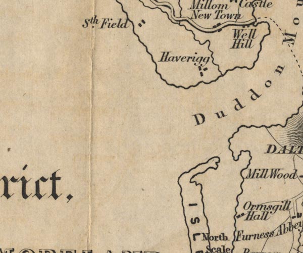 FD02SD17.jpg "Ormsgill Hall" item:- JandMN : 100.1 Image © see bottom of page |
|
|
|
||
| evidence:- | database:- Listed Buildings 2010 placename:- Ormsgill Farm item:- date stone |
|
| source data:- | courtesy of English Heritage "ORMSGILL FARMHOUSE / / ORMSGILL LANE / BARROW IN FURNESS / BARROW IN FURNESS / CUMBRIA / II[star] / 388549 / SD1918871366" |
|
|
|
||
| evidence:- | database:- Listed Buildings 2010 |
|
| source data:- | courtesy of English Heritage "BARN AND OUTBUILDING ADJOINING ORMSGILL FARMHOUSE / / ORMSGILL LANE / BARROW IN FURNESS / BARROW IN FURNESS / CUMBRIA / II / 388550 / SD1918071346" |
|
|
|
||
 Lakes Guides menu.