 Old Cumbria Gazetteer
 |
 |
|
| Humble Dod, Northumberland | ||
| Humble Dod | ||
| county:- | Northumberland | |
| locality type:- | hill | |
| coordinates:- | NY731567 | |
| 1Km square:- | NY7356 | |
| 10Km square:- | NY75 | |
|
|
||
| evidence:- | perhaps old map:- Ford 1839 map placename:- Dod Law |
|
| source data:- | Map, uncoloured engraving, Map of the Lake District of
Cumberland, Westmoreland and Lancashire, scale about 3.5 miles
to 1 inch, published by Charles Thurnam, Carlisle, and by R
Groombridge, 5 Paternoster Row, London, 3rd edn 1843.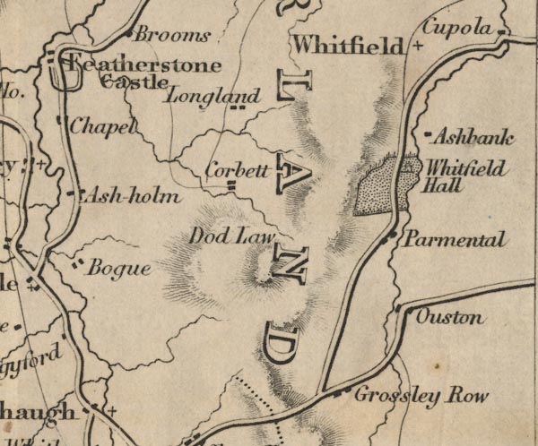 FD02NY75.jpg "Dod Law" Hill hachuring. item:- JandMN : 100.1 Image © see bottom of page |
|
|
|
||
 Lakes Guides menu.