Old Cumbria Gazetteer
 |
 |
|
||
| Gais Gill | ||||
| runs into:- |  Artlegarth Beck Artlegarth Beck |
|||
|
|
||||
| civil parish:- | Ravenstonedale (formerly Westmorland) | |||
| county:- | Cumbria | |||
| locality type:- | river | |||
| 1Km square:- | NY7101 (etc) | |||
| 10Km square:- | NY70 | |||
|
|
||||
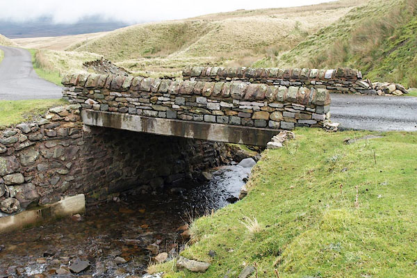
 CER38.jpg (taken 7.3.2016)  BPV41.jpg At the bridge. (taken 19.11.2008) |
||||
|
|
||||
| evidence:- | old map:- OS County Series (Wmd 29 16) placename:- Gais Gill |
|||
| source data:- | Maps, County Series maps of Great Britain, scales 6 and 25
inches to 1 mile, published by the Ordnance Survey, Southampton,
Hampshire, from about 1863 to 1948. |
|||
|
|
||||
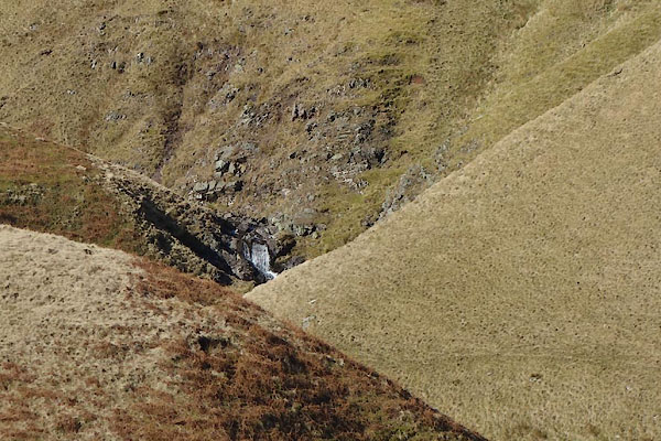 CER39.jpg Waterfall, (taken 7.3.2016) |
||||
|
|
||||
| places:- |
|
|||
Lakes Guides menu.