 Old Cumbria Gazetteer
 |
 |
|
| fingerpost, Sedbergh | ||
| Four Lane Ends | ||
| civil parish:- | Sedbergh (formerly Yorkshire) | |
| county:- | Cumbria | |
| locality type:- | road junction | |
| locality type:- | fingerpost | |
| coordinates:- | SD63249586 | |
| 1Km square:- | SD6395 | |
| 10Km square:- | SD69 | |
|
|
||
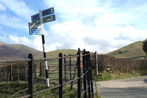 BOX75.jpg Modern style, with bicycle routes. (taken 31.3.2008) |
||
|
|
||
| evidence:- | old map:- OS County Series (Yrk 48 6) placename:- Four Lane Ends |
|
| source data:- | Maps, County Series maps of Great Britain, scales 6 and 25
inches to 1 mile, published by the Ordnance Survey, Southampton,
Hampshire, from about 1863 to 1948. "Four Lane Ends / G.P" |
|
|
|
||
 Lakes Guides menu.