 Old Cumbria Gazetteer
 |
 |
|
| Cunsey, Satterthwaite | ||
| Cunsey | ||
| civil parish:- | Satterthwaite (formerly Lancashire) | |
| civil parish:- | Claife (formerly Lancashire) | |
| county:- | Cumbria | |
| locality type:- | locality | |
| coordinates:- | SD38129355 (etc) | |
| 1Km square:- | SD3893 | |
| 10Km square:- | SD39 | |
|
|
||
| evidence:- | old map:- Jansson 1646 |
|
| source data:- | Map, hand coloured engraving, Cumbria and Westmoria, ie
Cumberland and Westmorland, scale about 3.5 miles to 1 inch, by
John Jansson, Amsterdam, Netherlands, 1646.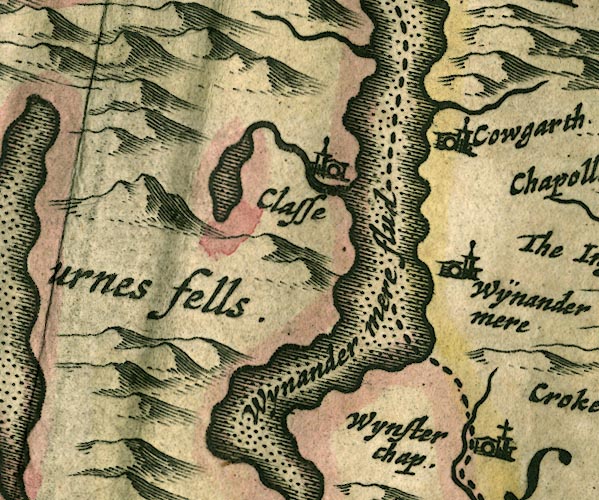 JAN3SD39.jpg Single wiggly line. item:- JandMN : 88 Image © see bottom of page |
|
|
|
||
| evidence:- | old map:- Ford 1839 map placename:- Cunsey |
|
| source data:- | Map, uncoloured engraving, Map of the Lake District of
Cumberland, Westmoreland and Lancashire, scale about 3.5 miles
to 1 inch, published by Charles Thurnam, Carlisle, and by R
Groombridge, 5 Paternoster Row, London, 3rd edn 1843.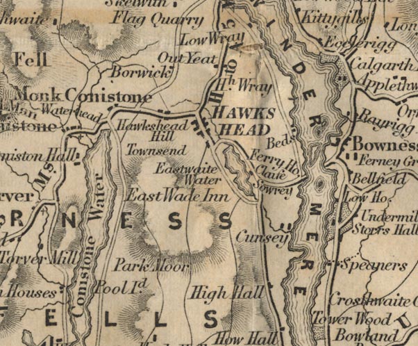 FD02SD39.jpg "Cunsey" item:- JandMN : 100.1 Image © see bottom of page |
|
|
|
||
| evidence:- | old print:- Calverley 1899 item:- cist |
|
| source data:- | Kist panel, Cunsey:-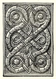 click to enlarge click to enlargeCV1155.jpg Sketch by W G Collingwood. item:- JandMN : 190 Image © see bottom of page |
|
|
|
||
 Lakes Guides menu.