 Old Cumbria Gazetteer
 |
 |
|
| Clifton Moor, Clifton | ||
| Clifton Moor | ||
| civil parish:- | Clifton (formerly Westmorland) | |
| county:- | Cumbria | |
| locality type:- | moor | |
| coordinates:- | NY535263 | |
| 1Km square:- | NY5326 | |
| 10Km square:- | NY52 | |
|
|
||
| evidence:- | old map:- OS County Series (Wmd 8 1) placename:- Clifton Moor |
|
| source data:- | Maps, County Series maps of Great Britain, scales 6 and 25
inches to 1 mile, published by the Ordnance Survey, Southampton,
Hampshire, from about 1863 to 1948. OS County Series (Wmd 8 2) In the area of the moor between A6 and railway on sheet Wmd 8 1 is:- "A skirkish took place here between the Royal troops under the Duke of Cumberland, and those of the Pretender, December 1745" |
|
|
|
||
| evidence:- | old map:- Jefferys 1770 (Wmd) placename:- Clifton Moor |
|
| source data:- | Map, 4 sheets, The County of Westmoreland, scale 1 inch to 1
mile, surveyed 1768, and engraved and published by Thomas
Jefferys, London, 1770.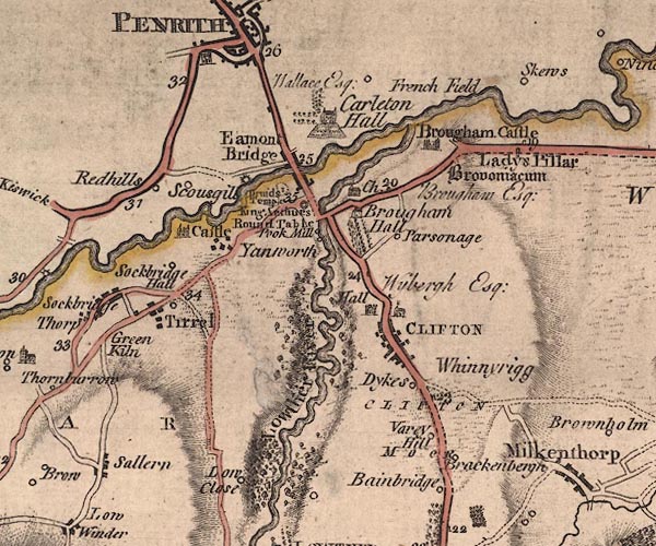 J5NY52NW.jpg "CLIFTON MOOR" area item:- National Library of Scotland : EME.s.47 Image © National Library of Scotland |
|
|
|
||
 Lakes Guides menu.