 Old Cumbria Gazetteer
 |
 |
|
| bridge, Buttermere | ||
| site name:- | Mill Beck (7) | |
| locality:- | Buttermere | |
| civil parish:- | Buttermere (formerly Cumberland) | |
| county:- | Cumbria | |
| locality type:- | bridge | |
| coordinates:- | NY17491699 | |
| 1Km square:- | NY1716 | |
| 10Km square:- | NY11 | |
|
|
||
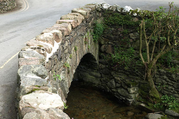 BVF58.jpg (taken 17.8.2011) |
||
|
|
||
| evidence:- | old map:- Donald 1774 (Cmd) |
|
| source data:- | Map, hand coloured engraving, 3x2 sheets, The County of Cumberland, scale about 1
inch to 1 mile, by Thomas Donald, engraved and published by Joseph Hodskinson, 29
Arundel Street, Strand, London, 1774.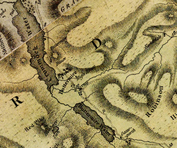 D4NY11NE.jpg double line across a river; a bridge in Buttermere item:- Carlisle Library : Map 2 Image © Carlisle Library |
|
|
|
||
| evidence:- | old print:- Rose 1832-35 (vol.3 no.23) |
|
| source data:- | Print, uncoloured engraving, Mill Beck, and Buttermere Chapel, Cumberland, drawn by
G Pickering, engraved by M J Starling, published by Fisher, Son and Co, London, 1832-35.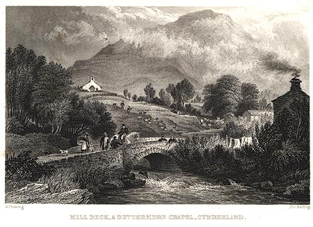 click to enlarge click to enlargePR0037.jpg vol.3 pl.23 in the set of prints, Westmorland, Cumberland, Durham and Northumberland Illustrated. printed at bottom left, right, centre:- "G. Pickering. / M. J. Starling. / MILL BECK, AND BUTTERMERE CHAPEL, CUMBERLAND." item:- Dove Cottage : 2008.107.37 Image © see bottom of page |
|
|
|
||
 Lakes Guides menu.