 Old Cumbria Gazetteer
 |
 |
|
| bridge, Brough (2) | ||
| site name:- | Swindale Beck (3) | |
| locality:- | Church Brough | |
| locality:- | Brough | |
| civil parish:- | Brough (formerly Westmorland) | |
| county:- | Cumbria | |
| locality type:- | bridge | |
| coordinates:- | NY793142 | |
| 1Km square:- | NY7914 | |
| 10Km square:- | NY71 | |
|
|
||
| evidence:- | old map:- Cary 1789 (edn 1805) |
|
| source data:- | Map, uncoloured engraving, Westmoreland, scale about 2.5 miles
to 1 inch, by John Cary, London, 1789; edition 1805.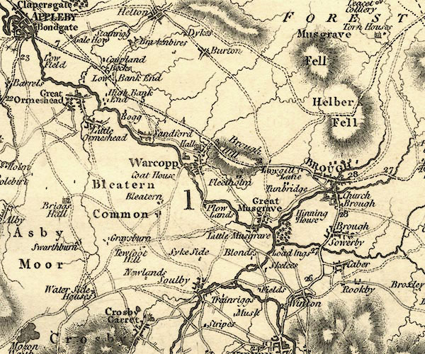 CY24NY71.jpg road across a stream; bridge over the Swindale Beck item:- JandMN : 129 Image © see bottom of page |
|
|
|
||
| evidence:- | old print:- |
|
| source data:- | Print, uncoloured engraving, Brough Castle, Westmorland, drawn by W Westall, engraved
by E Finden, about 1830s?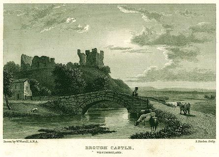 click to enlarge click to enlargePR0152.jpg This engraving is used as a vignette on Bell's map of the county, 1833. printed at bottom left, right, centre:- "Drawn by W. Westall, A.R.A. / E. Finden sculp. / BROUGH CASTLE, / WESTMORELAND." item:- Dove Cottage : 2008.107.152 Image © see bottom of page |
|
|
|
||
 Lakes Guides menu.