 Old Cumbria Gazetteer
 |
 |
|
| Bowscar Farm, Penrith | ||
| Bowscar Farm | ||
| locality:- | Bowscar | |
| civil parish:- | Penrith (formerly Cumberland) | |
| county:- | Cumbria | |
| locality type:- | buildings | |
| locality type:- | locality | |
| coordinates:- | NY51573446 | |
| 1Km square:- | NY5134 | |
| 10Km square:- | NY53 | |
|
|
||
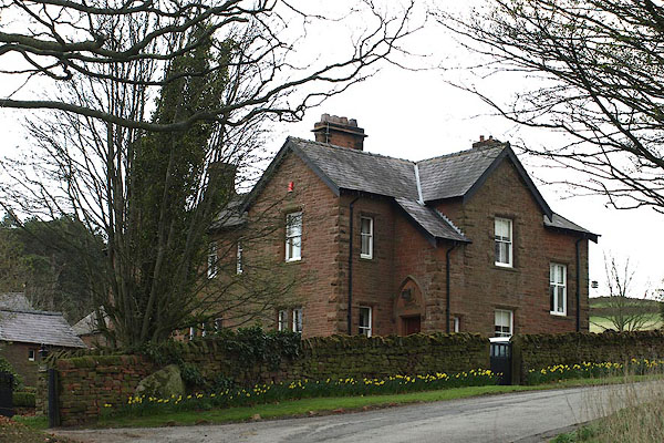 BOY37.jpg (taken 4.4.2008) |
||
|
|
||
| evidence:- | old map:- Otley 1818 placename:- Bow Scar |
|
| source data:- | Map, uncoloured engraving, The District of the Lakes,
Cumberland, Westmorland, and Lancashire, scale about 4 miles to
1 inch, by Jonathan Otley, 1818, engraved by J and G Menzies,
Edinburgh, Scotland, published by Jonathan Otley, Keswick,
Cumberland, et al, 1833.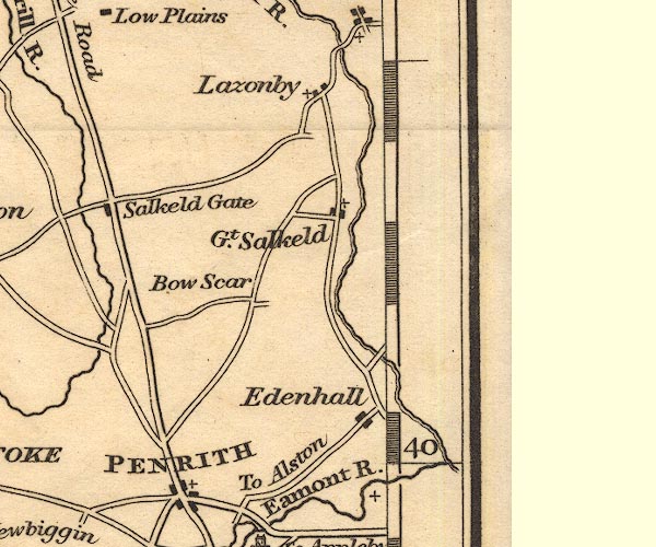 OT02NY53.jpg Label only, no feature. item:- JandMN : 48.1 Image © see bottom of page |
|
|
|
||
| evidence:- | old map:- Garnett 1850s-60s H placename:- Bow Scar |
|
| source data:- | Map of the English Lakes, in Cumberland, Westmorland and
Lancashire, scale about 3.5 miles to 1 inch, published by John
Garnett, Windermere, Westmorland, 1850s-60s.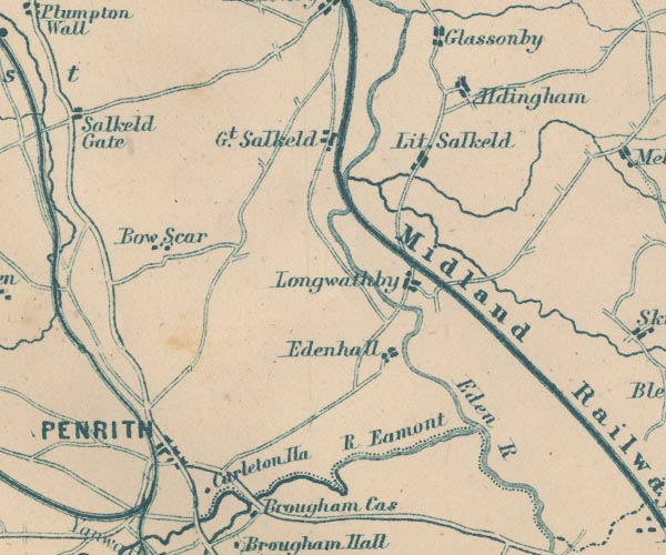 GAR2NY53.jpg "Bow Scar" blocks, settlement item:- JandMN : 82.1 Image © see bottom of page |
|
|
|
||
 Lakes Guides menu.