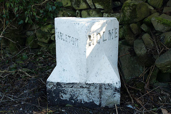


BQA84.jpg Inscribed stone:-
"FARLETON / HOLME" and bench mark
(taken 6.2.2009)
courtesy of English Heritage
"BOUNDARY STONE APPROXIMATELY 500 METRES SOUTH SOUTH WEST OF TOWNEND FARM / / A6070 / BEETHAM / SOUTH LAKELAND / CUMBRIA / II / 76564 / SD5319980292"
"BOUNDARY STONE APPROXIMATELY 500 METRES SOUTH SOUTH WEST OF TOWN END FARM, FARLETON / / A 6070 / HOLME / SOUTH LAKELAND / CUMBRIA / II / 76674 / SD5319980291"
courtesy of English Heritage
"Boundary stone. Probably early C19. Dressed limestone upright stone with flat top and deep chamfers with pyramid stops to front corners. Painted black and white with black Bans-serif lettering diagonally on each chamfer: FARLETON to North, HOLME to South (Farleton Parish now incorporated into Beetham). Bench mark on base. Similar to series of milestones and boundary stones listed in neighbouring parishes. Also listed under BEETHAM Parish."

 Lakes Guides menu.