 Old Cumbria Gazetteer
 |
 |
|
| boundary sign, Nateby (2) | ||
| site name:- | Hollow Mill Cross | |
| civil parish:- | Nateby (formerly Westmorland) | |
| county:- | Cumbria | |
| locality type:- | boundary sign | |
| locality type:- | county boundary mark | |
| locality type:- | roadsign | |
| coordinates:- | NY81170405 | |
| 1Km square:- | NY8104 | |
| 10Km square:- | NY80 | |
| site name:- | Yorkshire Dales National Park | |
| county:- | North Yorkshire | |
| current boundary | ||
| locality:- | Cumbria boundary | |
| old boundary | ||
| locality:- | Westmorland boundary | |
|
|
||
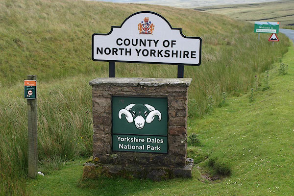 BPL33.jpg "COUNTY OF / NORTH YORKSHIRE" "Yorkshire Dales / National Park" The next sign down says Welcome to Richmondshire. (taken 10.7.2008) |
||
|
|
||
 Lakes Guides menu.