 Old Cumbria Gazetteer
 |
 |
|
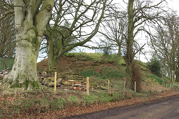
| motte, Irthington | ||
| locality:- | Irthington | |
| civil parish:- | Irthington (formerly Cumberland) | |
| county:- | Cumbria | |
| locality type:- | motte | |
| coordinates:- | NY49946151 | |
| 1Km square:- | NY4961 | |
| 10Km square:- | NY46 | |
|
|
||
 BOX23.jpg (taken 29.3.2008) |
||
|
|
||
| evidence:- | old map:- OS County Series (Cmd 17 7) |
|
| source data:- | Maps, County Series maps of Great Britain, scales 6 and 25
inches to 1 mile, published by the Ordnance Survey, Southampton,
Hampshire, from about 1863 to 1948. "Castle (Site of)" |
|
|
|
||
| hearsay:- |
Robert de Vaux, Baron of Gilsland, had his castle here in early norman times. King
John stayed here in 1201. |
|
|
|
||
| notes:- |
motte; site of a manor house, now demolished; |
|
| Perriam, D R &Robinson, J: 1998: Medieval Fortified Buildings of Cumbria: CWAAS::
ISBN 1 873124 23 6; illustration |
||
|
|
||
 Lakes Guides menu.