 Old Cumbria Gazetteer
 |
 |
|
| Storrs, Windermere | ||
| Storrs | ||
| civil parish:- | Windermere (formerly Westmorland) | |
| county:- | Cumbria | |
| locality type:- | area | |
| coordinates:- | SD395940 (etc) | |
| 1Km square:- | SD3994 | |
| 10Km square:- | SD39 | |
|
|
||
| evidence:- | old map:- Jefferys 1770 (Wmd) placename:- Stores |
|
| source data:- | Map, 4 sheets, The County of Westmoreland, scale 1 inch to 1
mile, surveyed 1768, and engraved and published by Thomas
Jefferys, London, 1770.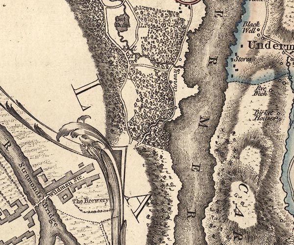 J5SD39SE.jpg "Stores" blocks, labelled in italic lowercase text; settlement, village? item:- National Library of Scotland : EME.s.47 Image © National Library of Scotland |
|
|
|
||
| evidence:- | old map:- Cary 1789 (edn 1805) placename:- Stors |
|
| source data:- | Map, uncoloured engraving, Westmoreland, scale about 2.5 miles
to 1 inch, by John Cary, London, 1789; edition 1805.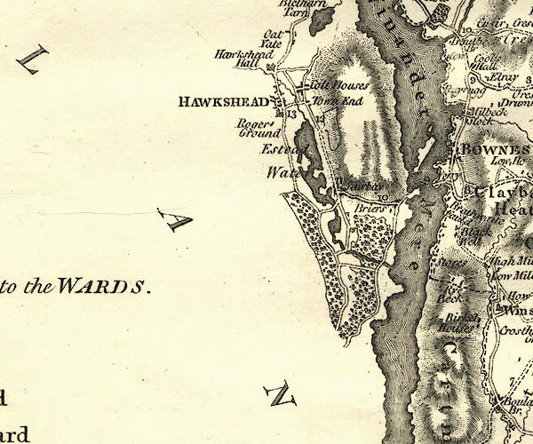 CY24SD39.jpg "Stors" block/s, labelled in italic lowercase; house, or hamlet item:- JandMN : 129 Image © see bottom of page |
|
|
|
||
| evidence:- | old print:- Harwood 1842 placename:- Storrs Point |
|
| source data:- | Print, uncoloured engraving, Storr's Point, Windermere, Westmoreland, engraved and
published by John and Frederick Harwood, 26 Fenchurch Street, London, 1842.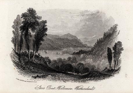 click to enlarge click to enlargeHRW201.jpg printed at bottom left, centre, right:- "London, J &F. Harwood, 26, Fenchurch Street. / Storr's Point, Windermere, Westmoreland. / June 10th. 1842." item:- JandMN : 166.1 Image © see bottom of page |
|
|
|
||
 Lakes Guides menu.