 Old Cumbria Gazetteer
 |
 |
|
| earthwork, Ponsonby | ||
| locality:- | Ponsonby | |
| civil parish:- | Ponsonby (formerly Cumberland) | |
| county:- | Cumbria | |
| locality type:- | earthwork | |
| locality type:- | pele tower | |
| coordinates:- | NY06050612 | |
| 1Km square:- | NY0606 | |
| 10Km square:- | NY00 | |
| references:- | Ford 1839 |
|
|
|
||
| evidence:- | old map:- OS County Series (Cmd 78 2) |
|
| source data:- | Maps, County Series maps of Great Britain, scales 6 and 25
inches to 1 mile, published by the Ordnance Survey, Southampton,
Hampshire, from about 1863 to 1948. "CAMP" and earthworks |
|
|
|
||
| evidence:- | old map:- Donald 1774 (Cmd) |
|
| source data:- | Map, hand coloured engraving, 3x2 sheets, The County of Cumberland, scale about 1
inch to 1 mile, by Thomas Donald, engraved and published by Joseph Hodskinson, 29
Arundel Street, Strand, London, 1774.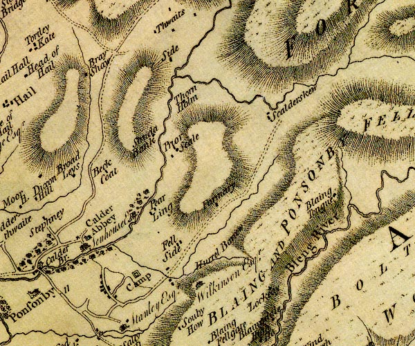 D4NY00NE.jpg "Camp" square within a square; roman fort item:- Carlisle Library : Map 2 Image © Carlisle Library |
|
|
|
||
| notes:- |
supposed garth to a pele tower |
|
| Perriam, D R &Robinson, J: 1998: Medieval Fortified Buildings of Cumbria: CWAAS::
ISBN 1 873124 23 6 |
||
|
|
||
 Lakes Guides menu.